
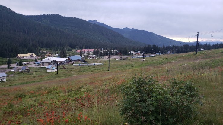
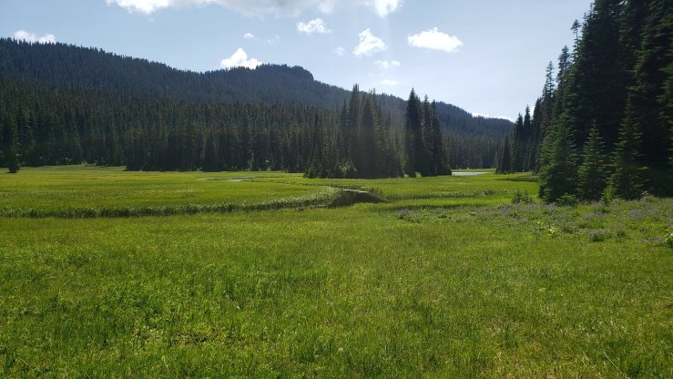
After a hiker’s share of beer and food, we ended up camping at the trailhead rather than hiking any miles. So early on day 93, we left Snoqualmie Pass, hiking up through the ski slopes that were covered in wildflowers. The trail continued on under a series of powerlines before heading through mostly forest, passing the occasional small lake. We camped on an unused dirt road at mile 281.8, a 22.3 mile day. The weather was pleasant and mosquito-free, so Inge, Sunny and I had a nice campfire and drank some Fireball whiskey before calling it a night.
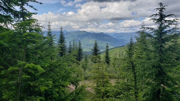
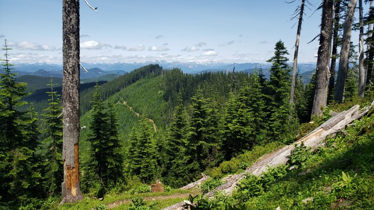
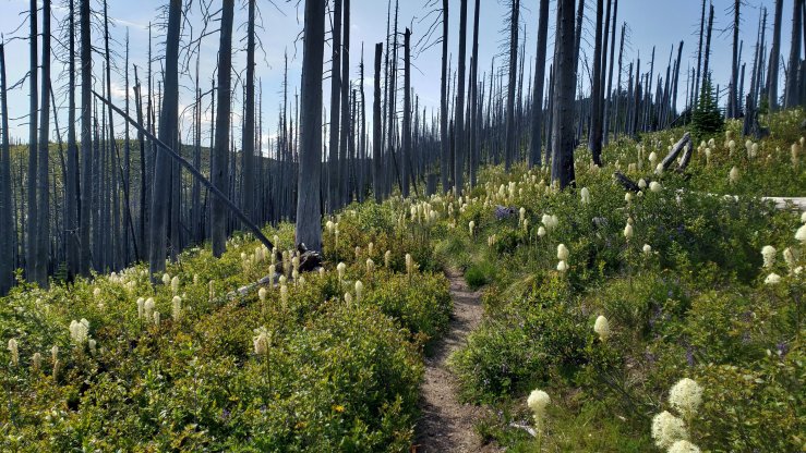
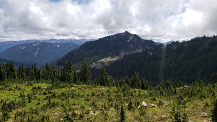
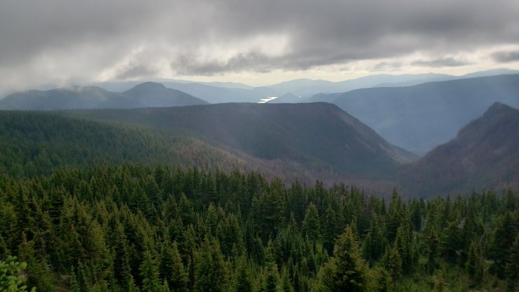
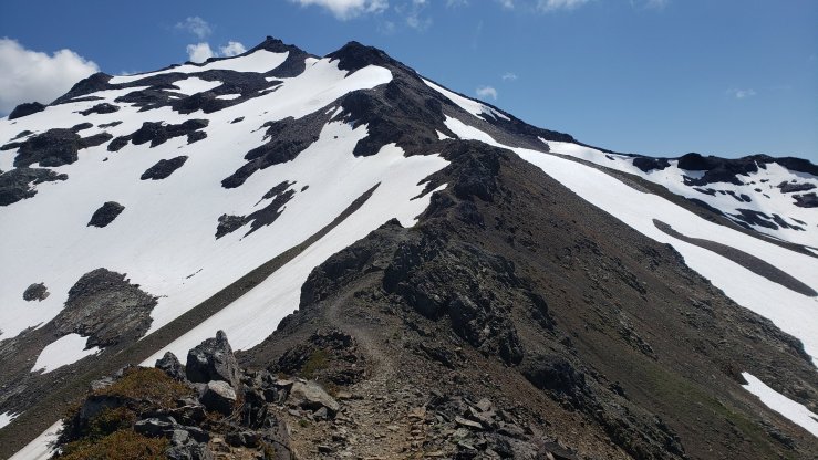
Day 94 was sunny and decently warm, which made for a nice day of hiking. The trail provided many views of the rolling green mountains in the area as it climbed and descended all day. Despite having nearly no flat sections, the day was not bad as the trail was well-maintained and mostly dirt. A burn area near the end of the day was filled with wildflowers, a neat contrast. We camped near the Mike Urich cabin, a 23.8 mile day. Another fire was had, with Milk Jug, Blueberry, and Colleen the Machine joining us.


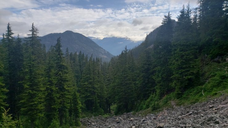
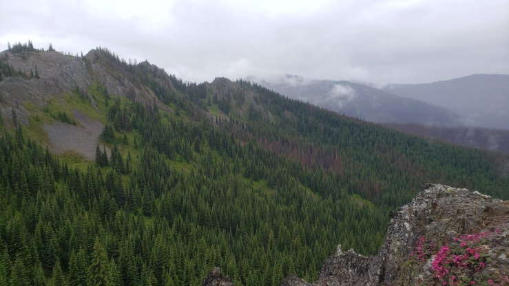
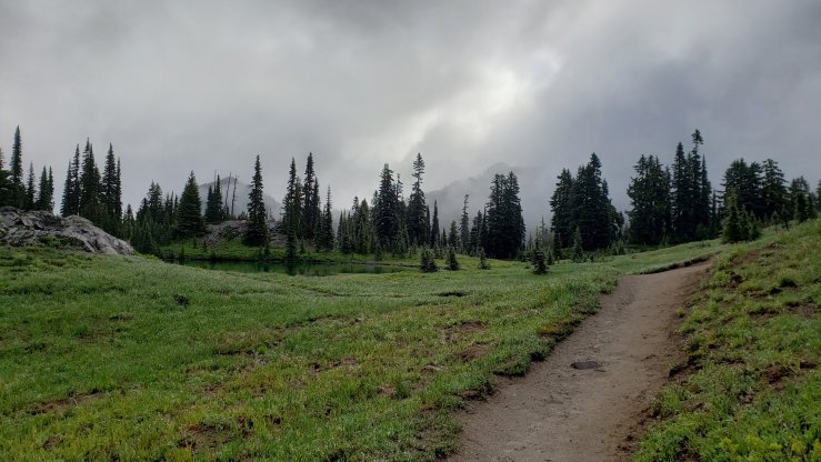
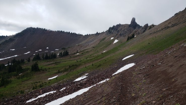
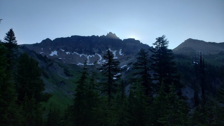
We awoke to rain on day 95. It rained basically all day, sometimes barely a drizzle and occasionally a near downpour. This meant few views, despite passing over open trail that almost certainly provides stellar views on a clear day. I kept my head down and headphones in, letting myself fall into an automatic state as I listened to audiobooks and podcasts to pass the time. We made it a shorter day because of the crummy weather, hiking 21.3 miles to Sheep Lake at mile 326.9. The same crew joined us at camp again, as well as Solo, although there wasn’t too much socializing on the wet and chilly night.
On day 97, we had just 6 miles to hike to get to White Pass. I got up early, around 5, to try to beat the mosquitoes, and managed to dig a cathole fairly unperturbed. By the time I was leaving camp around 6, the bastards were out in force. I made the miles easily, and got to the Kracker Barrel gas station (no relation to the chain of restaurants) at White Pass shortly after 8. Inge, Sunny and I decided to head into Packwood to avoid the rain that was coming, and so we booked a room at the Packwood Inn. An employee came to pick us up a little later, and by 10 AM we were in town. We spent the day eating and drinking, and especially enjoyed Taco Wednesday at the saloon.

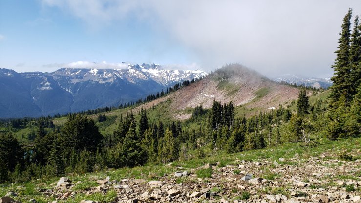

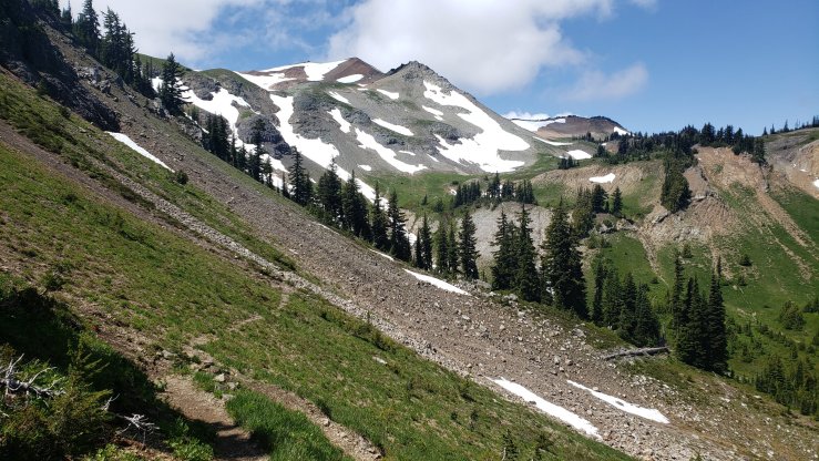


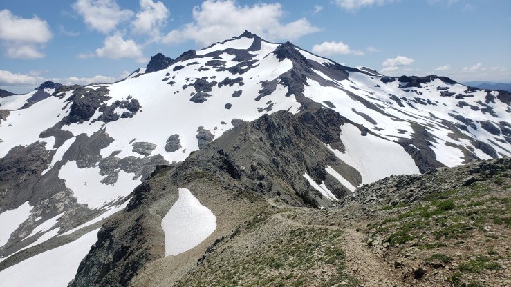
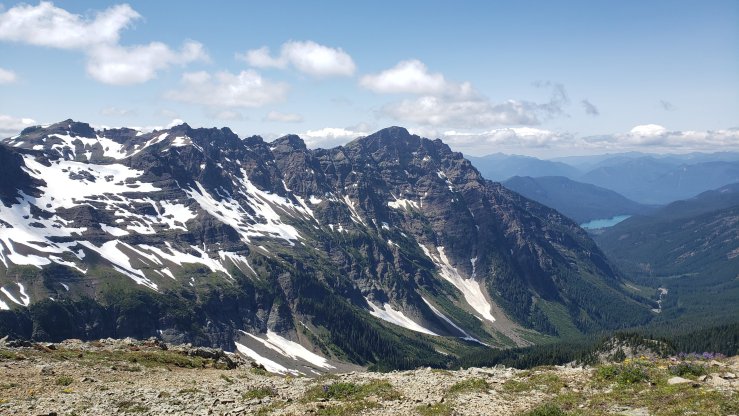
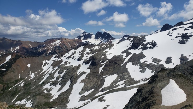


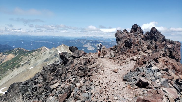

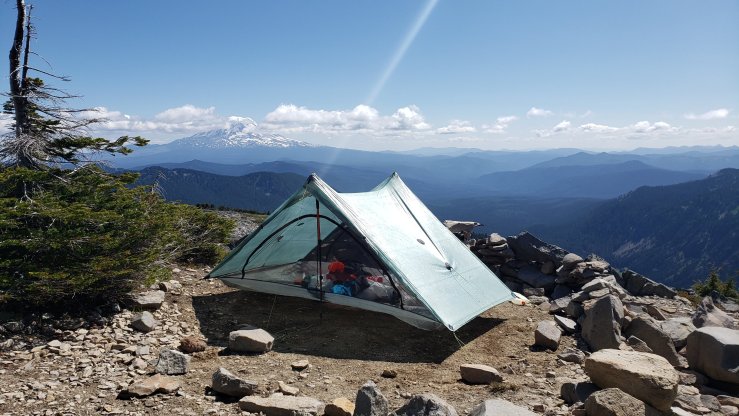
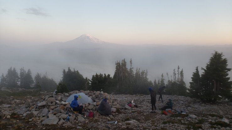
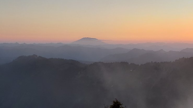

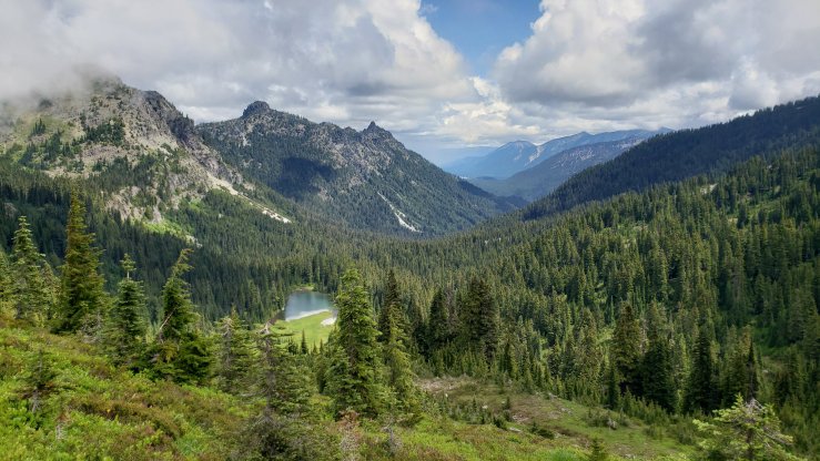
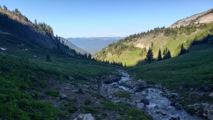
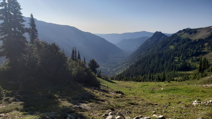
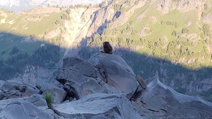
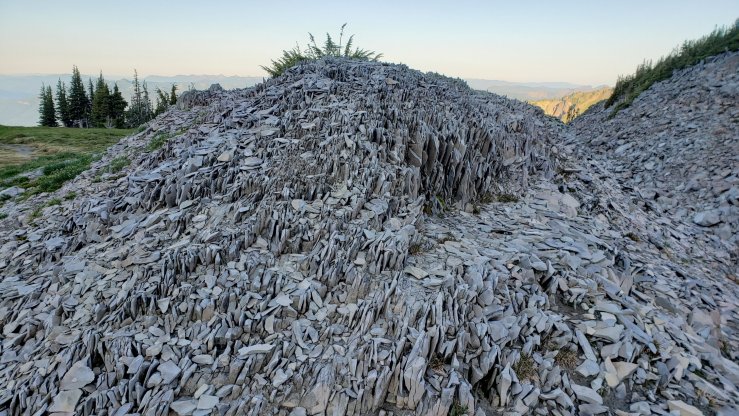
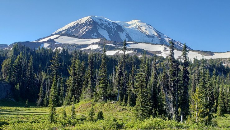
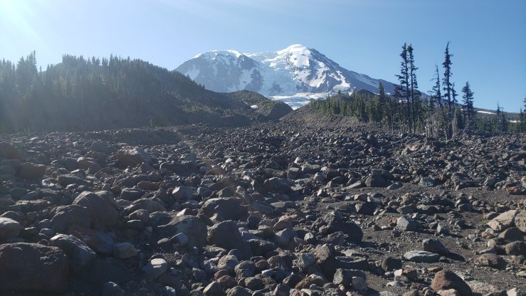
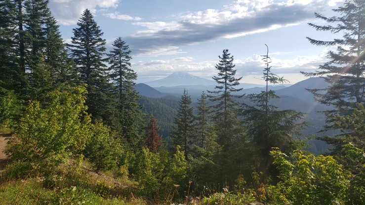
Day 100 was a bluebird day, not a cloud in the sky as I rose early. I snapped a few sunrise shots before leaving camp, a bit sad that this incredible area would be ending already today. Some charismatic marmots posed for me as I passed, and some of the rock piles were unlike anything I’d seen before. The Cispus valley was pretty, still in the morning shade as the sun climbed the peaks. Once over Cispus Pass, the Yakima Reservation valley opened up before me. A short while later, another excellent view of Adams was had before the trail descended into the forest for the rest of the day. We camped near a field of lava rocks, where a spring gushed forth, filtered by the igneous rock. It was a 26.8 mile day, ending at mile 403.1.


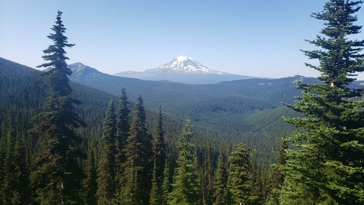


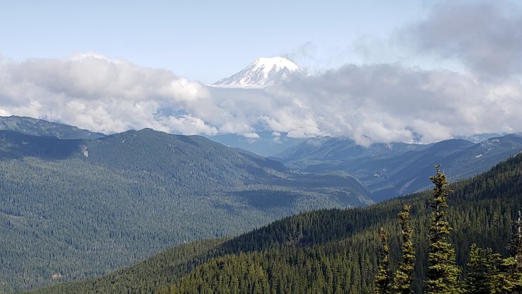
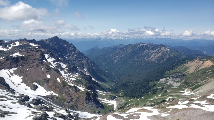
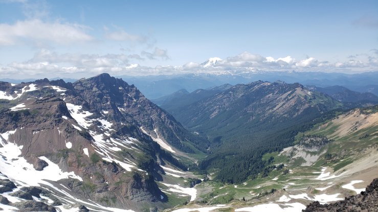
On day 101, we had the opportunity to go into Trout Lake, where we could get burgers and beer. It was 20.5 miles to the road where one can hitch to the minuscule town, so I got going fairly early. The trail passed mostly through fairly buggy forest, occasionally opening up to grant awesome views of Mt. Adams and Mt. Rainier. After a few miles, the trail opened up in a sub-alpine area. The sun was shining, there was a decent breeze, and views all around, but the day was marred a bit by mosquitoes yet again. I made the miles quickly and got an easy hitch into town around 1:30. I vented my frustration with the mosquitoes to the girls over lunch, and decided to hitch to Bingen, WA to visit Margie’s Pot Shop to resupply on safety supplies. I caught a ride in about 5 minutes, as two nice women who were avid hikers themselves picked me up. A half-hour later I was at my destination, and after getting what I needed, I was on the side of the road again, thumb out. I got back to the trailhead in three hitches, waiting less than a half-hour combined. We had planned to do 5 more miles rather than stay in town. I made the miles quickly as we camped near Trout Lake Creek at mile 428.8.


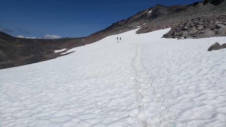
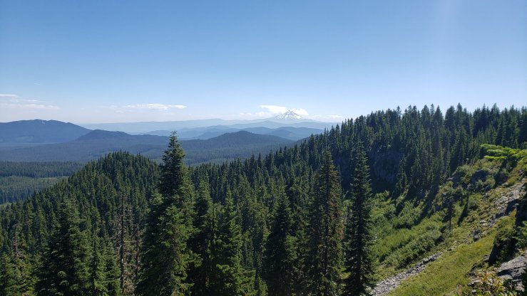
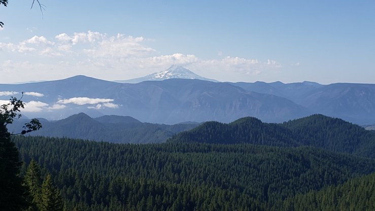
Day 102 was Indian Heaven Wilderness, AKA the worst mosquito day in Washington. I knew this ahead of time, and so I spent the entire day in my wind pants and wind jacket, also frequently donning a bugnet over my head. It was hot but better than being eaten alive. Most of the day was not terrible, though around some lakes they got very aggressive. Blue Lake provided a nice breeze however, and I was able to enjoy lunch there before finishing up the day. The day was mostly spent in buggy forest, though we did get our first good look at Mt. Hood. We camped near a gravel road and trailhead, at the end of the Indian Heaven Wilderness. The bugs were thankfully not too bad at our campsite at mile 454.7.

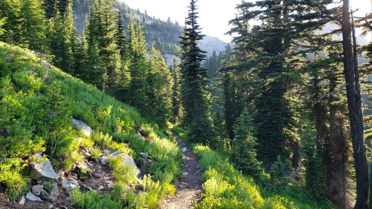
The morning of day 103 was worryingly buggy as I packed up camp, but after a short cruise the forest opened up and the mosquitoes essentially vanished. I caught up to Inge fairly quickly, and we had a nice break at the top of the morning’s climb, enjoying another great view of Mt. Adams. We spent the next few miles stopping often to eat wild huckleberries off their bushes, many perfectly ripe. They were delicious, and it was hard to stay focused on hiking. The trail descended steadily for nearly ten miles down to Panther Creek, where we stopped for lunch. The long descent put us at only about 900 feet above sea level, and accordingly it was quite warm, easily in the 90s under the sun. I stripped to my underwear and laid down in the shallow snowmelt creek, which was icy cold but incredibly refreshing. After having lunch and drying off in the sun, I finished the hike through the forest, camping at another unused dirt road at mile 480.2, a 25.5 mile day.

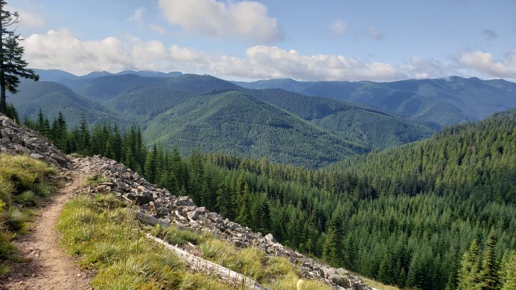
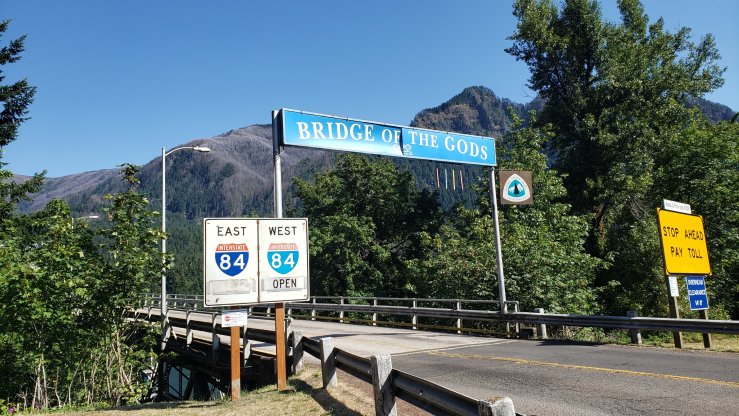
Day 104 would be the last hiking day in Washington. We had 25.3 miles to hike to get to the Bridge of the Gods, which spans the Columbia River and crosses into Oregon. There were a few nice views after the big climb of the day, but otherwise the day was spent mostly on cruisy trail through the woods. As I descended towards the Columbia and therefore sea level, the temperature soared and it felt sweltering under the sun. I made it to the highway and quickly got a hitch into Stevenson, where Sunny, Inge and I had a hotel reserved for the next two nights. We did laundry and showered before getting beer and snacks at the grocery store, and tacos from a taco truck. We spent the rest of the evening relaxing at the hotel.


Today is day 105, and it’s a zero day in Stevenson. I got an awesome breakfast roll at a nearby espresso hut — a sourdough roll stuffed with bacon, sausage, potatoes, onions, peppers and cheese, grilled with crispy cheese sealing the top. It was as good as it sounds. I got my beard trimmed at a local barber before getting a new hiking shirt at the thrift shop and resupplying for the next six days at the grocery store. We plan on heading into Cascade Locks, across the bridge, later today to claim a couple supposedly free beers at local breweries. There’s a bluegrass festival in town starting tonight as well, so we might check that out as well. Oregon awaits!

More amazing photos and tales of the trail. Love it! I hope the new tent and new shoes are treating you well! Hopefully Oregon will treat you well with less mosquitoes! Have a blast and stay safe, love you!
LikeLike