PCT California Section A – Revisit

I received a text in late January from an old high school friend asking if I’d like to go on a hike sometime in the next few weeks. My friend had recently left employment voluntarily to enjoy life for a bit and wondered if I’d be up for a trip somewhere warm, perhaps a week or so. I quickly accepted and soon suggested the southernmost 110 miles of the Pacific Crest Trail, from the Mexican border outside Campo to Warner Springs, CA. This section mostly sticks to elevations below 5,000 feet, promising decent weather for a late February hike.

I’d sworn off flying for the next year after a recent trip for work from my new home in northwest Washington back to the Midwest. The brutal disdain for humanity apparent in every facet of the modern airport/airplane experience drives me to anxiety and depression, and yet I found myself happily booking a flight to San Diego just weeks after returning to the Pacific Northwest. I even decided to pay a little extra to fly in/out of my little local airport instead of SeaTac. Quicker than the 2.5 hour shuttle each way, I told myself.

I leaned on my knowledge from last year to get us to the trail via public transportation. The 894 runs from El Cajon to Campo—a nearly two-hour journey by bus—every weekday a few times a day, at the reasonable cost of $8 one way. The plan for returning to civilization from Warner Springs, a little outpost in the middle of nowhere, SoCal, was something along the lines of, “I don’t know, we’ll hitch it or something.” Good enough.

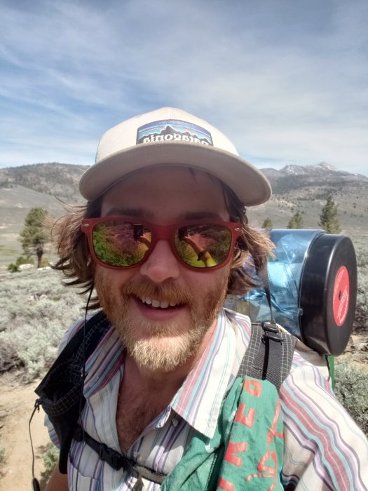
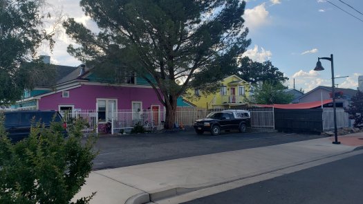
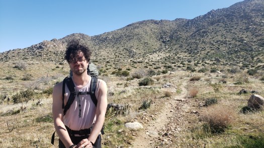
It was a pleasure to see my friend in the lower level of the San Diego terminal following a year and a half apart. He’d shaved and cut his hair but was still the same person I’d last seen in October 2018. The heat drove off our layers immediately as we exited the airport into sunny San Diego. The faint humidity from the ocean gave the early afternoon’s warmth an embracing feeling, one welcoming and particularly redolent of the sense of vacation. We caught an Uber to El Cajon, where our hotel awaited.

Only the finest Motel 6 double, of course. The cheap hardwood laminate, sterile décor, and mold-ridden air conditioner gave the impression of somewhere between an asylum and a dentist’s lobby—and apparently Motel 6 no longer believes guests wash their hair with shampoo, providing only two bars of soap for the room’s line of complimentary hygiene products (not a unique experience, I can say after staying at another one of these forsaken hellholes for some masochistic reason upon my return to San Diego at the end of this trip)—but it was a cheap place to stay for the night while we prepared our gear and ourselves for the hike ahead.

My friend had dramatically overpacked, resulting in an hours-long shakedown to rid him of unnecessary gear and food, at one point encompassing both uncomfortable beds. He decided to mail the excess stuff home. This was fine, as I needed to stop at the post office in Campo in the morning anyway, to pick up the bits of gear the pleasant and wholly necessary folks at the TSA view as contraband in carry-on luggage that I’d mailed ahead (again, a tactic that had worked well last year).

As I was smoking a cigarette in the grungy hotel parking lot at the interchange of Magnolia and I-8, a transient wandered through, playing a nameless tune surprisingly well on a harmonica. I wondered briefly if my shoddy health insurance would cover any injuries sustained in Southern California, then decided not to worry about it.

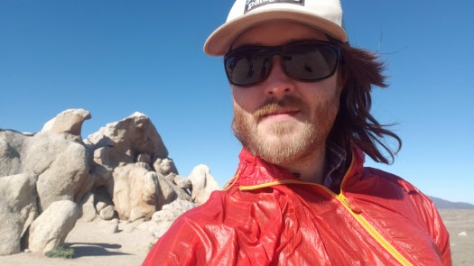
We were the only hikers on the bus the following morning. I’d forgotten how hard the seats in the bus were. Hostile design rearing its lovely head once again. My ass was nearly numb when we arrived in Campo just after 10 AM, the temperature somewhere in the low-60s under mostly sunny skies. It was a near perfect day to hike.

After a brief stop at the post office, we walked south through the barely existent town of Campo. We passed the local border patrol facility, complete with a cramped cage half-covered with tarps by some lazy fascist, packed with a couple dozen brown-skinned immigrants, mostly women and children by the glimpses we got. It left a sour taste as we walked the dusty streets south toward the border and the PCT southern terminus monument.

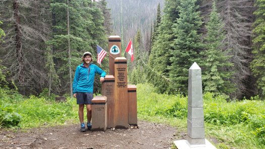
The mile-and-a-half to the border is a slow but steady climb, and by the time we reached the monument I was painfully aware of how out of shape I’d gotten in the winter. It had been nearly four months since I’d last hiked more than ten miles, I realized in some shock. Just seven months prior I’d hiked marathon days with ease. The thought of pushing that many miles now made me laugh.

IMG_0906.JPG

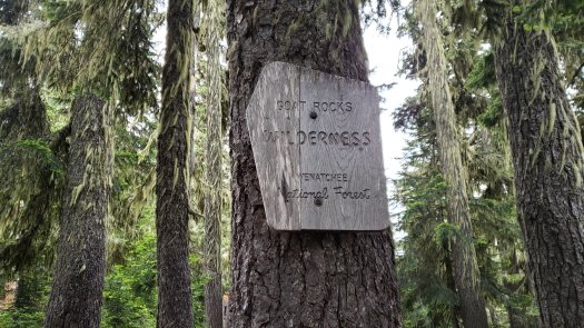
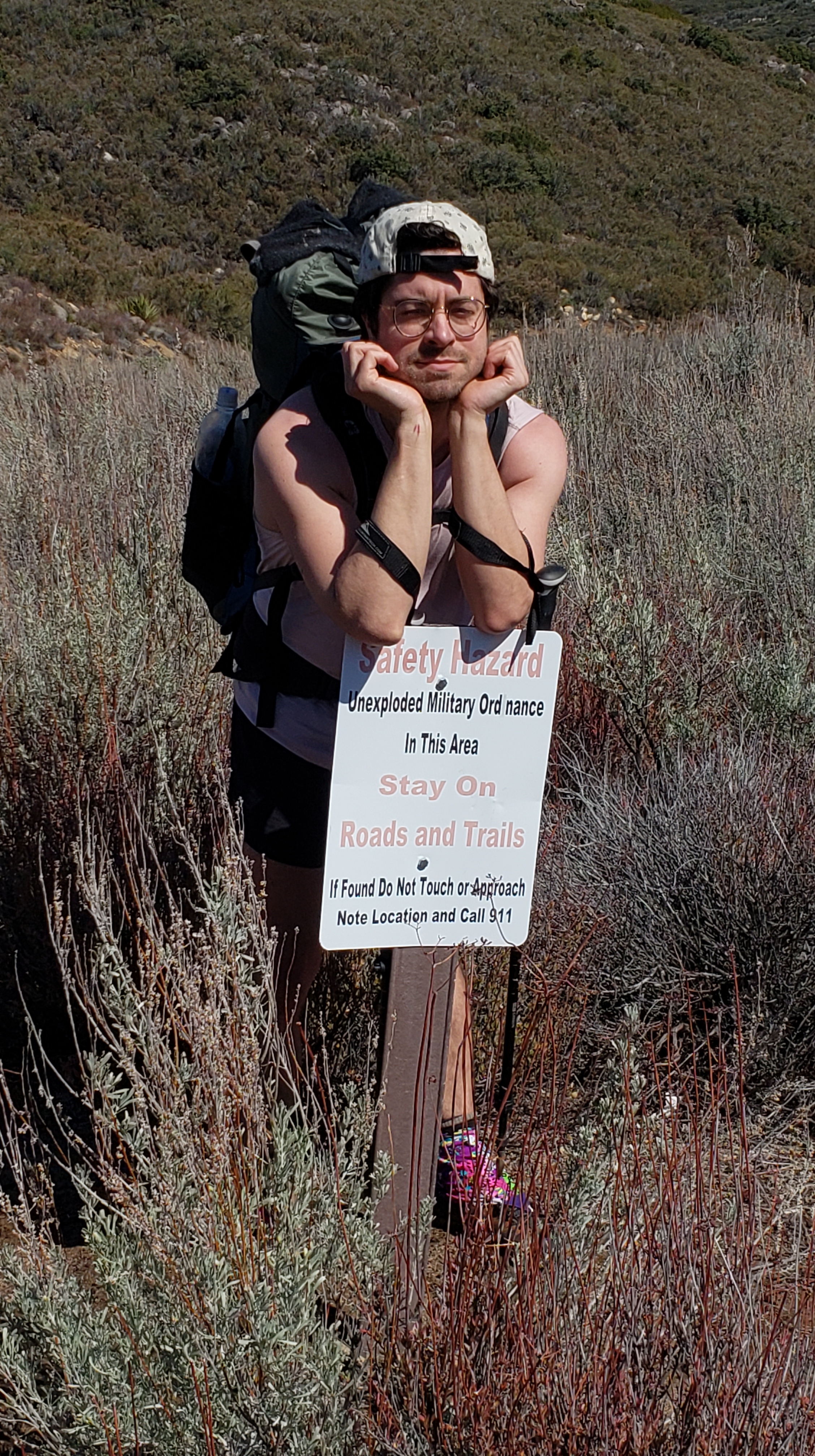
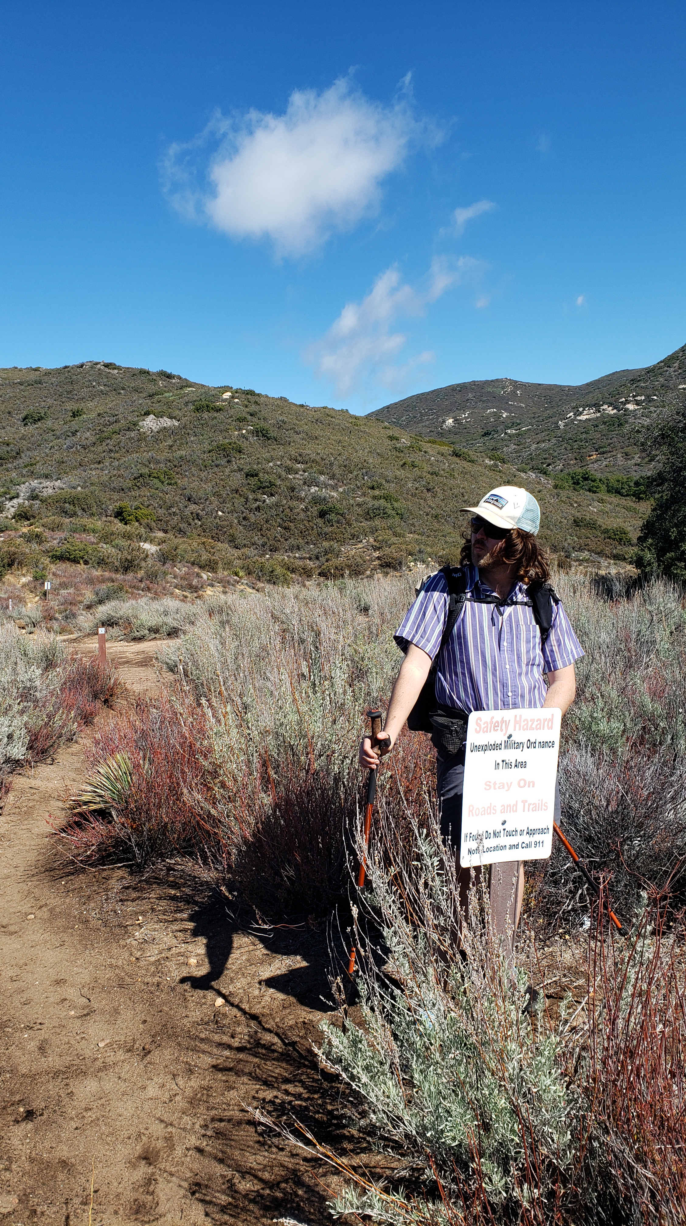
The monument was the same as ever, though this year it was just my friend and I gathered before it. Last year I had found myself in the company of roughly ten others who’d similarly opted for public transport over the generosity or obligation of others, plus a few PCT volunteers keeping track of numbers. The informality of this year’s beginning felt much freer than last year’s, and I found myself nostalgic for a time I never knew, when these trails were nearly empty compared to the enormous popularity of thru-hiking America’s long-distance scenic trails today—a problem to which I knowingly contribute, caught up in the same wave of outdoor awareness. At least getting on the trail before the PCTA’s newly-designated Southern California PCT Thru Hike Season of March 1 – May 31 allowed us a glimpse of the sort of solitude every thru-hiker enjoyed (or suffered through) decades ago.

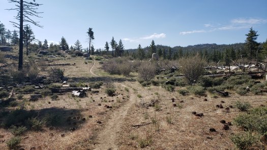
We signed the trail register and snapped a few vanity pictures before setting off on the trail proper. 110 miles north was the goal. We began the morning of Friday, February 21. My flight home was booked for 7:30 AM, Saturday, February 29, so we had a solid week to hike the miles and figure out how to get back to the urban corridor along the shore. Turning away from the hideous corrugated steel fencing to face the sprawling Southern Californian mountains, we passed the first trail marker and were on our way.

20200221_110129.jpg

To avoid dealing with permits, we had to stick to a fairly rigid itinerary the first three days. This schedule happened to match that of my hike last year, so it would be fairly easy to manage. By mile six, I found my heart pounding, my feet hot, my shoulders sore, and my head swimming under the desert sun. Ah, the joys of backpacking.

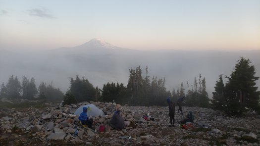
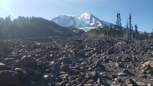
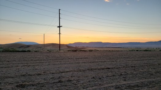
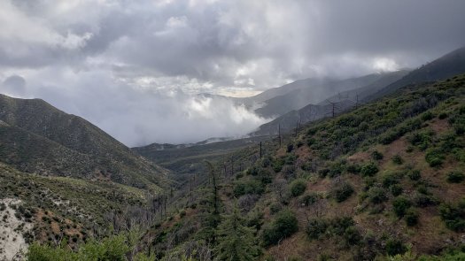
We hobbled into camp at mile 11.3, sore but satisfied with a decent first day. Border Patrol helicopters continued droning above this way and that, as they had all day. Rain loomed on the western horizon, and was forecast to persist through the following day, after which we were to have clear weather. One day of rain would be manageable, particularly as we would encounter the precipitation before ascending into the Laguna Mountains, where that rain could have well been snow. The gathering clouds provided a canvas on which the setting sun painted a remarkable scene of molten gold.

20200221_174138.jpg

I slept like the dead and my friend reported the same. Remarkable how comfortable a narrow air mattress on firm earth can be after a hard day’s hiking.

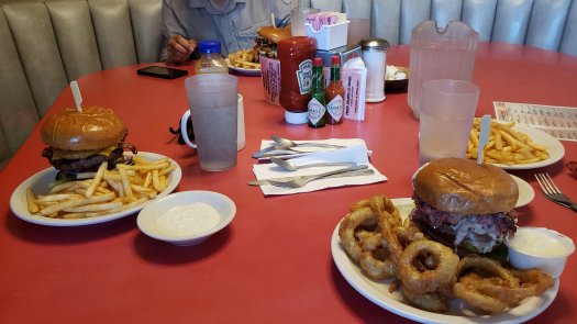
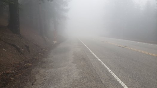
The rain held off most of the morning as we ascended Hauser Mountain, though we found ourselves caught in a downpour of cold bullets and sharp sleet less than a mile out of the Malt Shop in Lake Morena. We dried off while inhaling well-earned (20 total miles is well-earned, yeah?) double bacon cheeseburgers. The rain let up a few hours later, so we set off to our destination of Boulder Oaks Campground, six miles further up the trail.

20200222_091027.jpg

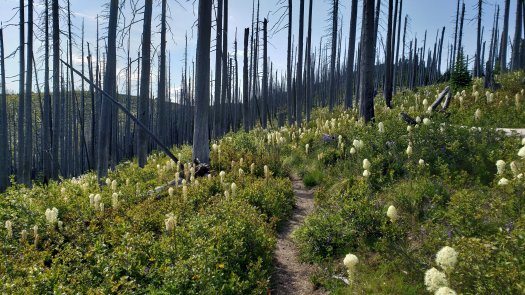
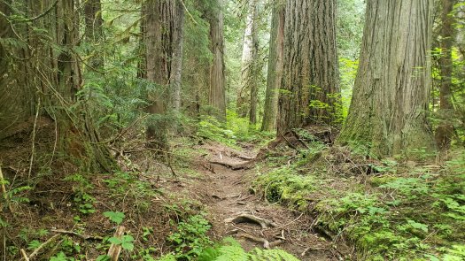
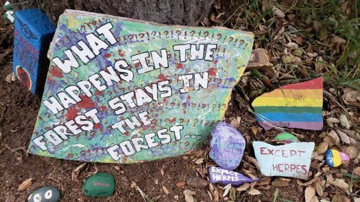
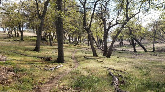
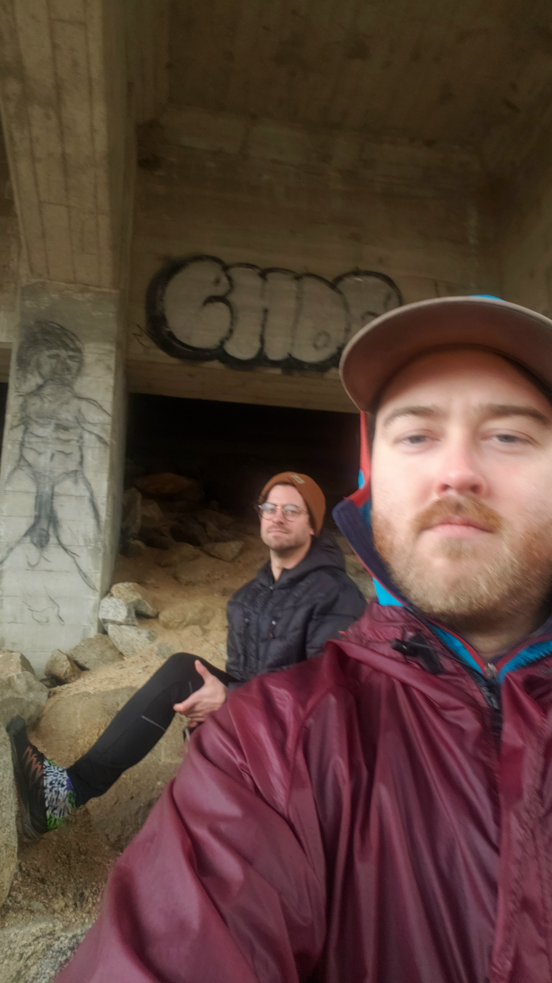
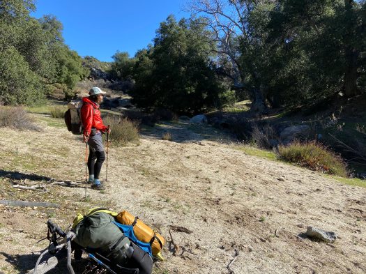
Another spell of rain trapped us below an overpass, where we enjoyed the talents of the local graffiti artists. The rain passed again, and we walked the last couple miles through a years-old burn area next to the road beside the creek, an oddly pleasant section on trail in my opinion. The surviving oaks tower here over unkempt shin-high grasses, most evidence of desert chaparral missing entirely. Then one crosses the creek over a few well-placed boards, and the oak grove gives way to desert scrub once more, until the trail meanders into Boulder Oaks Campground, where the two biomes merge.

20200222_143443.jpg

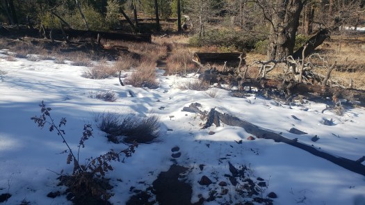
It quickly became frigid as the sun set below lingering rain clouds to the west. A few more periods of rain passed over during the chilly evening, and I found myself wearing most of my layers to stay warm. The desert is certainly a place of extremes and loves to remind hikers of it when it can.

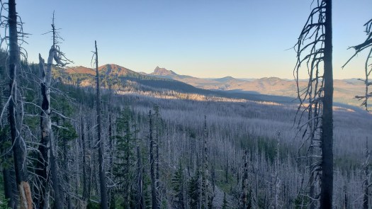
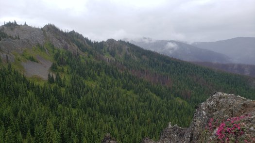
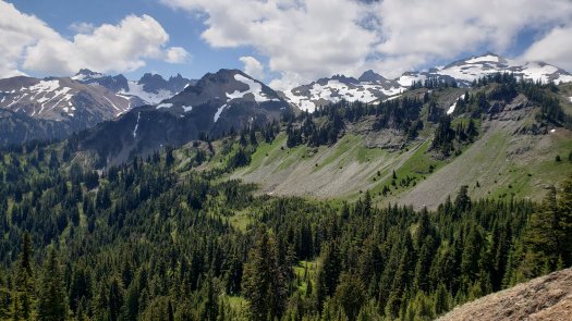
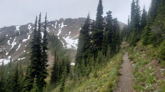
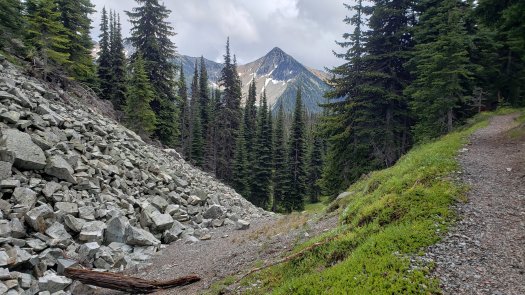
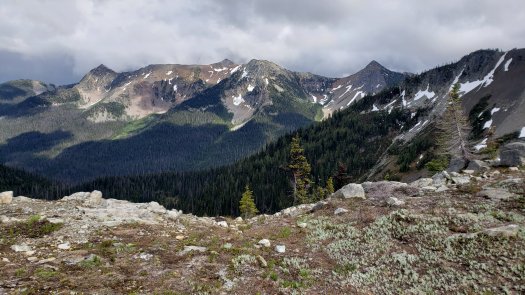
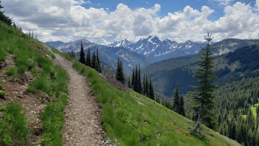
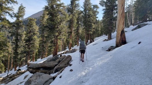
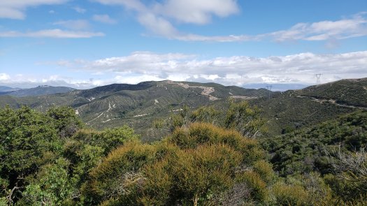
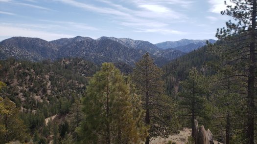
Clouds hung around the following morning, but the rain held off as we climbed into the canyon above Kitchen Creek and beyond, up the slow but steady fifteen-mile climb to Mount Laguna. Eventually the sun broke through and turned it into a lovely day.20200223_095327.jpg

20200223_111011.jpg

20200223_111046.jpg

20200223_120010.jpg

After arriving in town, we debated our plan for a bit before deciding to grab a bite at the Tavern/Cafe there. A delightfully odd experience in every regard, from the overbearing but kind owner who hissed at her cook when an exuberant “Oh shit!” came from the kitchen, the sort a guy issues when watching on a handheld screen a good sports play or another guy getting hit for something he probably deserved, to the nearly comedic in appearance couple, decked to the nines in proper cowboy regalia, his sixty-plus years to her barely-forty, his gray mustache as prominent as her pushed up cleavage. After some subpar house special mac and cheese, I waited for the male component of the cowboy couple while he used the restroom before me. Apparently, the man shit cologne, judging by the odor lingering after he left, heels clicking loudly on the knotty wood floor.

Having gently disregarded the instructions on where exactly we should camp, we suffered through another cold night. At nearly 6,000 feet, it fell below freezing into the upper 20s the third night. I awoke several times shivering, my pad having a slow leak that necessitated a few supplementary breaths throughout the night. R-Value is real, folks.

20200223_145117.jpg

20200224_084107.jpg

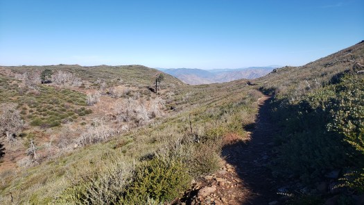
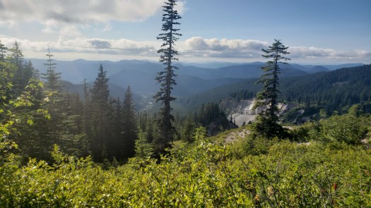
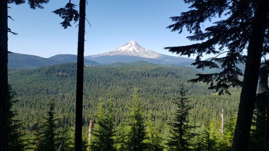
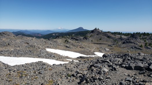
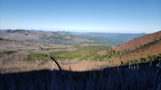
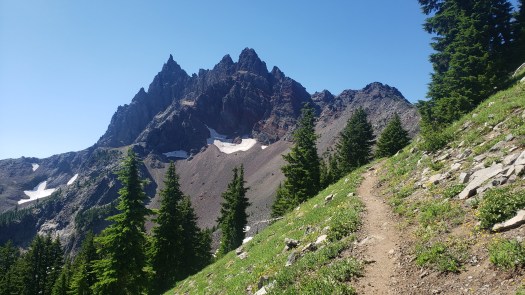
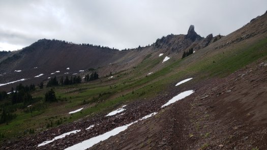
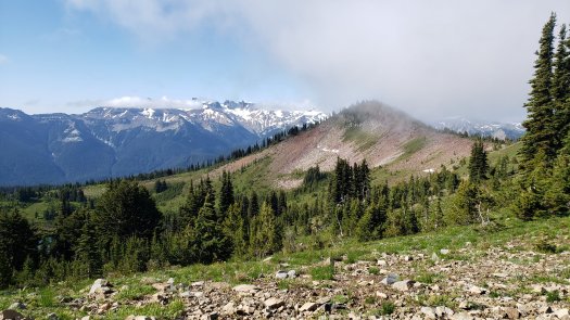
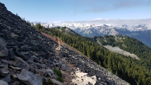
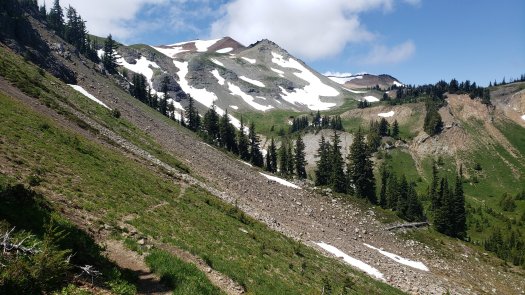
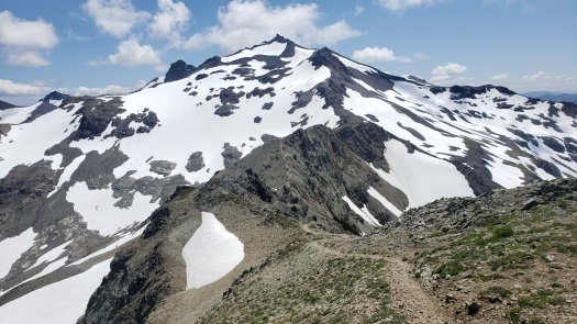
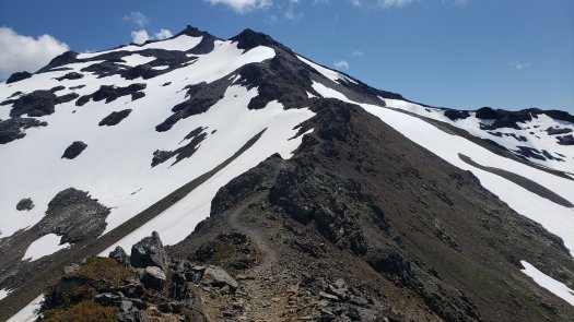
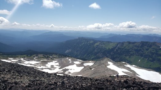
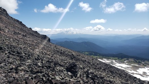
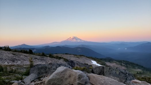
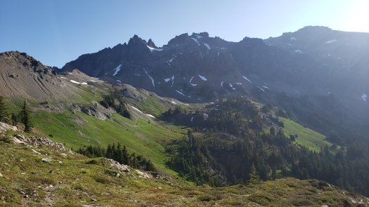
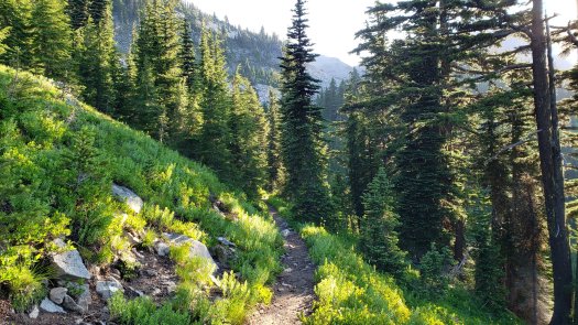
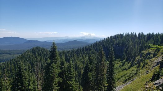
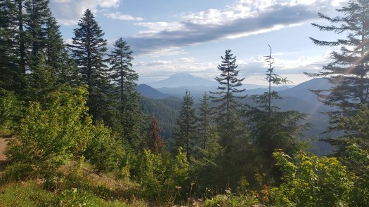
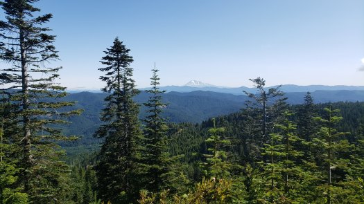
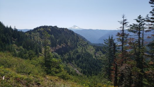
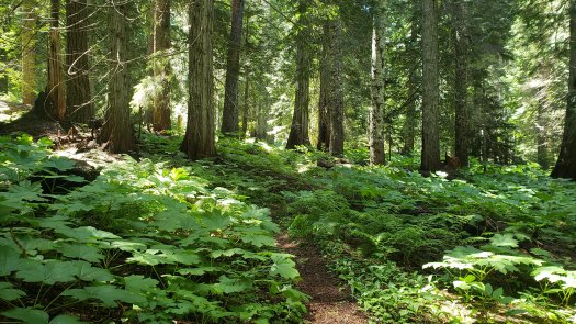
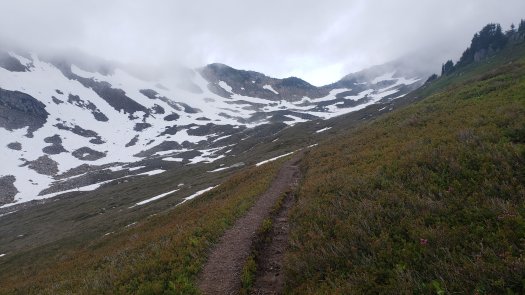
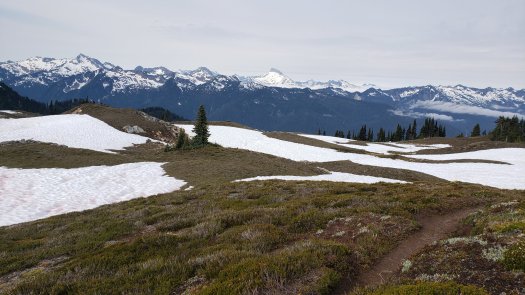
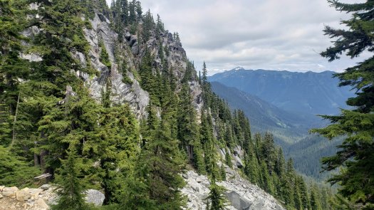
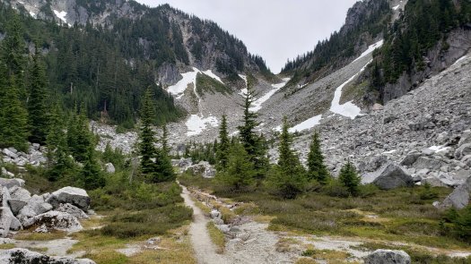
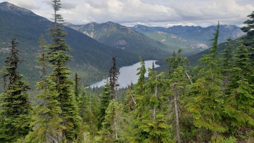
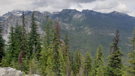
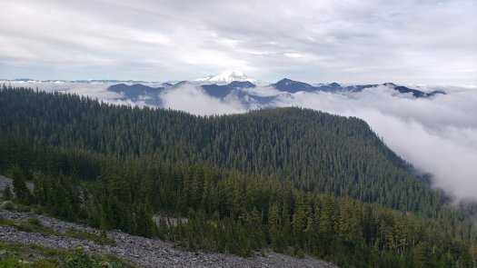
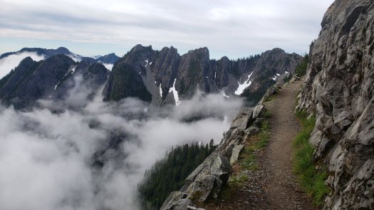
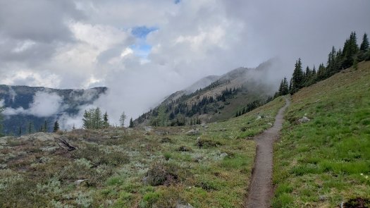
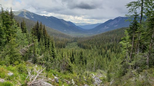
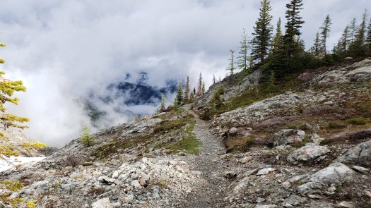
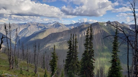
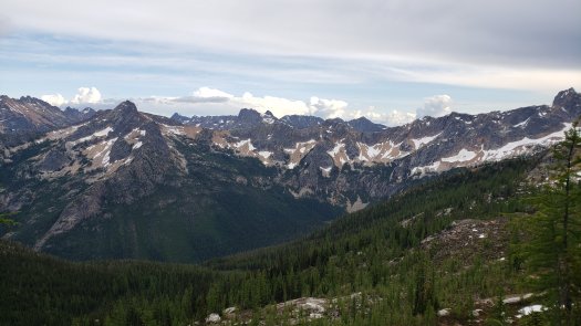
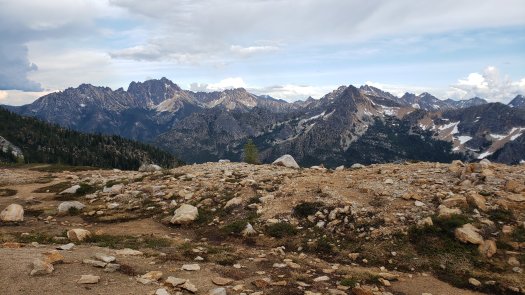
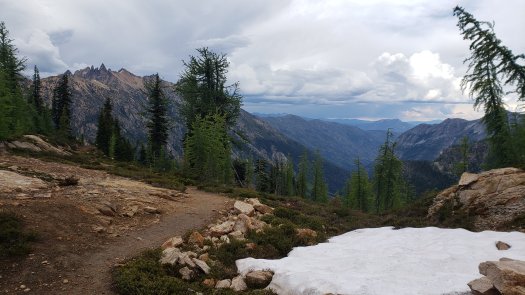
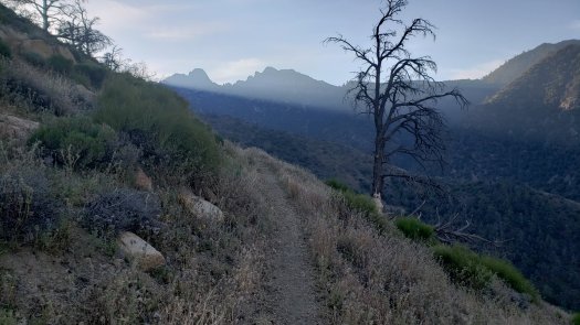
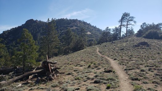
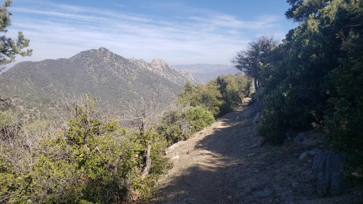
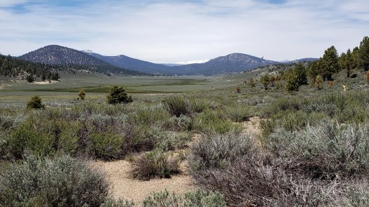
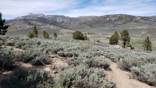
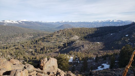
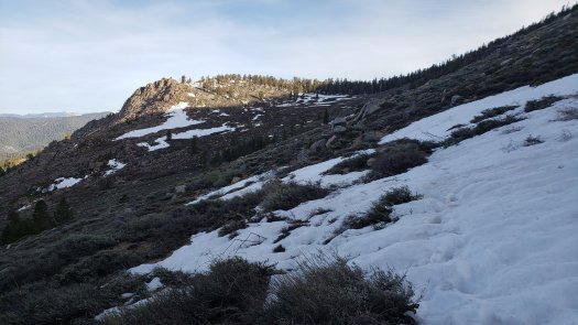
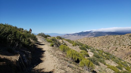
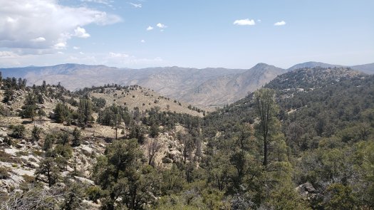
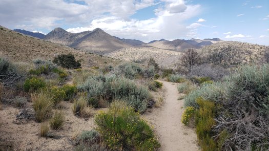
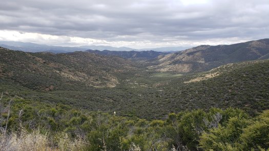
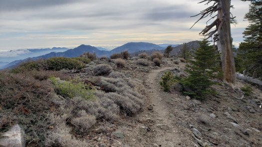
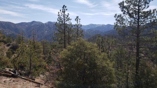
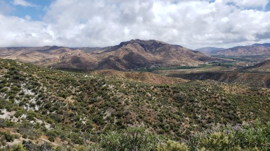
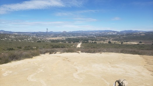
We rose to blue skies, and once the sun crept above the trees just after 7 AM, the day quickly warmed and became a perfect day to hike. The trail opened up a few miles in to, in my opinion, the gem view of the first hundred miles, looking north and east to the low desert. It is an incredibly huge view, particularly for a couple Midwestern kids. I’ve hiked well over fifteen hundred miles out west now, and the grandness of it all still leaves me breathless. There is simply no comparison to be found in the mostly flat forests of Wisconsin or Minnesota.

20200224_084809.jpg

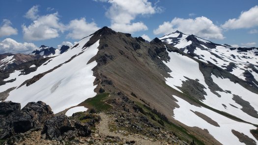
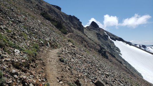
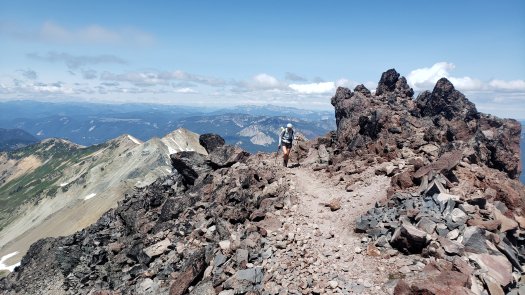
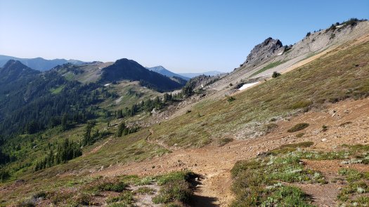
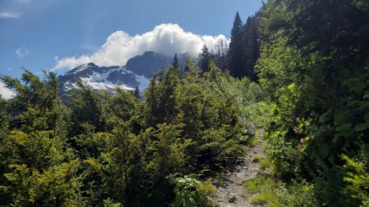
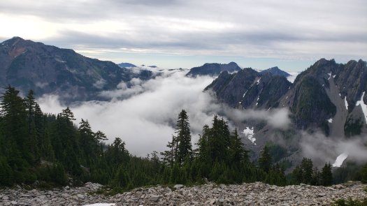
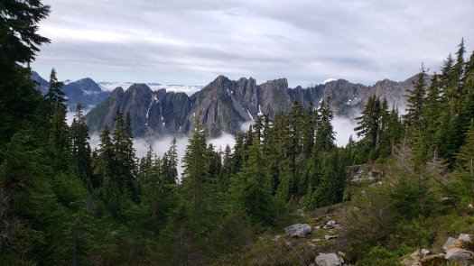
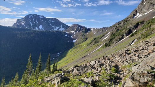
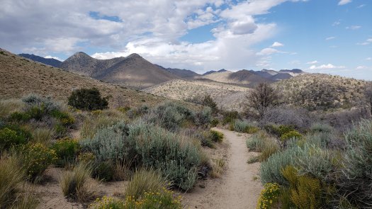
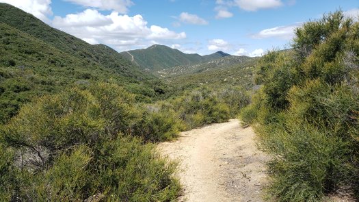
Cresting around narrow sections of trail that have a hiker walking a two-foot (at most) wide path between a near-vertical stone wall on their left and a thousands-foot sheer drop on the right, we joked that these are the parts of trail you don’t tell your mom about. I am awful at following this advice; so, sorry, mom. At least there weren’t 50+ mile per hour winds here this time.

20200224_130900.jpg

20200224_124627.jpg

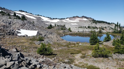
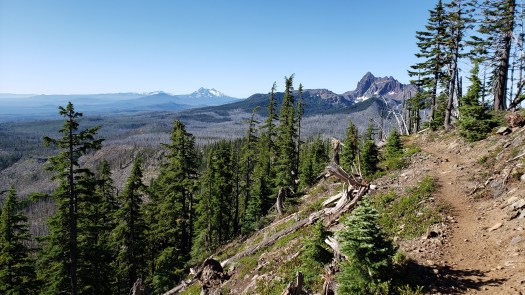
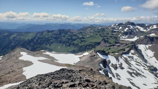
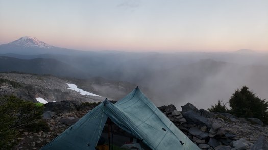
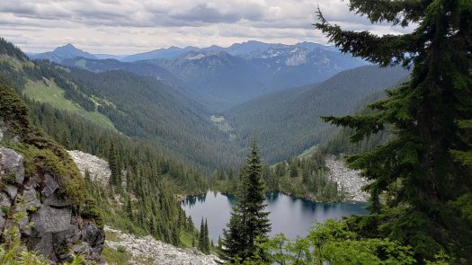
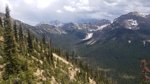
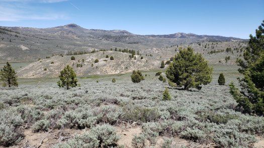
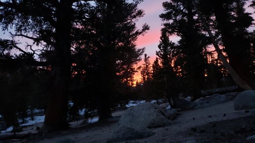
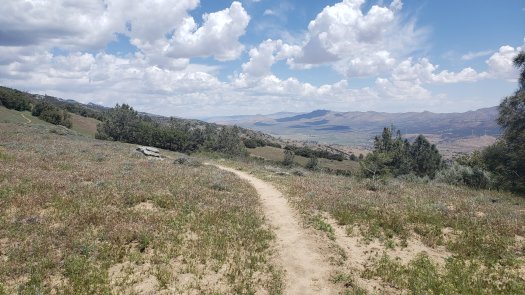
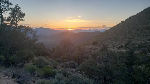
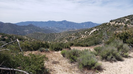
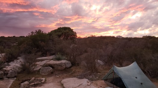
We found a place to camp amid stout manzanita trees, tucked into a little valley to block most of the winds. We were still around 5,000 feet, the sturdy SoCal winds ever-present along the slowly descending ridge from Mount Laguna to Scissors Crossing. A spectacular sunset and sunrise were both to be had here with a short climb out of the valley. The myriad layers and shades of pink, violet, and blue were enchanting in their own unique ways with dusk and dawn, from the cotton candy clouds drifting lazily by in the evening to the coral sky warming along the eastern horizon with the new morning’s first light.

20200224_173817.jpg

20200224_173828.jpg

20200225_060630.jpg

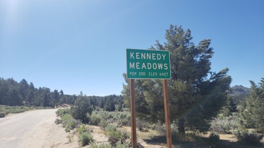
The fifth day was to be our longest of the trip. The initial plan was to hike the remaining 18 or so miles down to Scissors Crossing, get a hitch the three or so miles down the road to the Stagecoach RV Resort and Campground, and enjoy some food from their grill before camping there for the night. Julian, fifteen or so miles up the road the other way, would be on the following morning’s agenda for brunch before a shorter day to rest our legs a bit.

IMG_0971.jpg

20200225_130544.jpg

The plan, like any good plan, went to absolute shit. This turned out to be an incredibly fortunate twist of fate, we would later learn.

We hiked the day’s miles easy enough. The question of how we would get from Warner Springs back to public transport routes to go our separate ways at the end of the hike arose once more, this time more pressingly as we approached the hike’s end. My friend brought up that there was a bus from Julian to El Cajon on Friday morning, though our present itinerary would have us nowhere near Julian by Friday, Tuesday as it was. I, however, was inspired—nothing said we needed to hike the miles sequentially.

I suggested that we hitch from Scissors Crossing to Barrel Springs, 34 miles up the trail. From there, we could day hike to Eagle Rock five miles north, then turn back and proceed to hike south Wednesday and Thursday back to Scissors Crossing, arriving in time to catch the bus Friday morning. My friend agreed, so the new plan was to hitch to the RV Resort for food and resupply, then either camp and hitch to Barrel Springs in the morning or manage a hitch that night if we could.

We got to the road at Scissors Crossing around 1:30 PM and caught a hitch to the RV Resort right around 2 PM. The plan seemed to be going well until we arrived at Stagecoach to find they were closing early for the day for training purposes. We were offered the option to camp, which we briefly considered, but the broken promise of real hot food was too bitter to swallow. So, we declined and stood at the roadside, trying to hitch the three or so miles back to Scissors Crossing, where we would try for another hitch up to Julian for food and resupply.

The remaining hours of daylight were quickly fading, with the sun setting before 6 PM and full dark coming well before 6:30. After nearly a half-hour of no luck hitching, we began the hour-long road walk back to Scissors Crossing, cursing our luck.

About halfway through the road walk, a car passed, and its driver gave us an odd look. A moment later, the same car returned, pulling off to ask us where we were headed. “Julian,” we said, and she invited us in for a ride. The car was delightfully filthy, its middle-aged woman driver quirky and pleasant as she sped up the winding mountain road to Julian.

We arrived around 3:30 PM, less than two hours of proper daylight remaining. We had no intention to stay in Julian, as there is no affordable (read: less than $20 per night) camping or lodging in town. A brief but delicious late lunch at Miner’s Diner followed by a quick resupply at the corner market and a stop at the ATM, and we were ready to leave town by 4:45 PM, thumbs out at the roadside.

5 o’clock came and went without a ride as the sun began to slip below the tall trees of Julian, a fierce eastern wind ripping through town. We began to discuss getting a room at the local bed and breakfast (at over $100 per night) when another vehicle pulled a U-turn after passing. She asked if we were going to Scissors Crossing and we said yes; she said she was going there as well and offered us a ride with a smile. A fit middle-aged woman with vibrant red hair, she opened a trunk to reveal an HMG pack and other familiar gear. We were in good company.

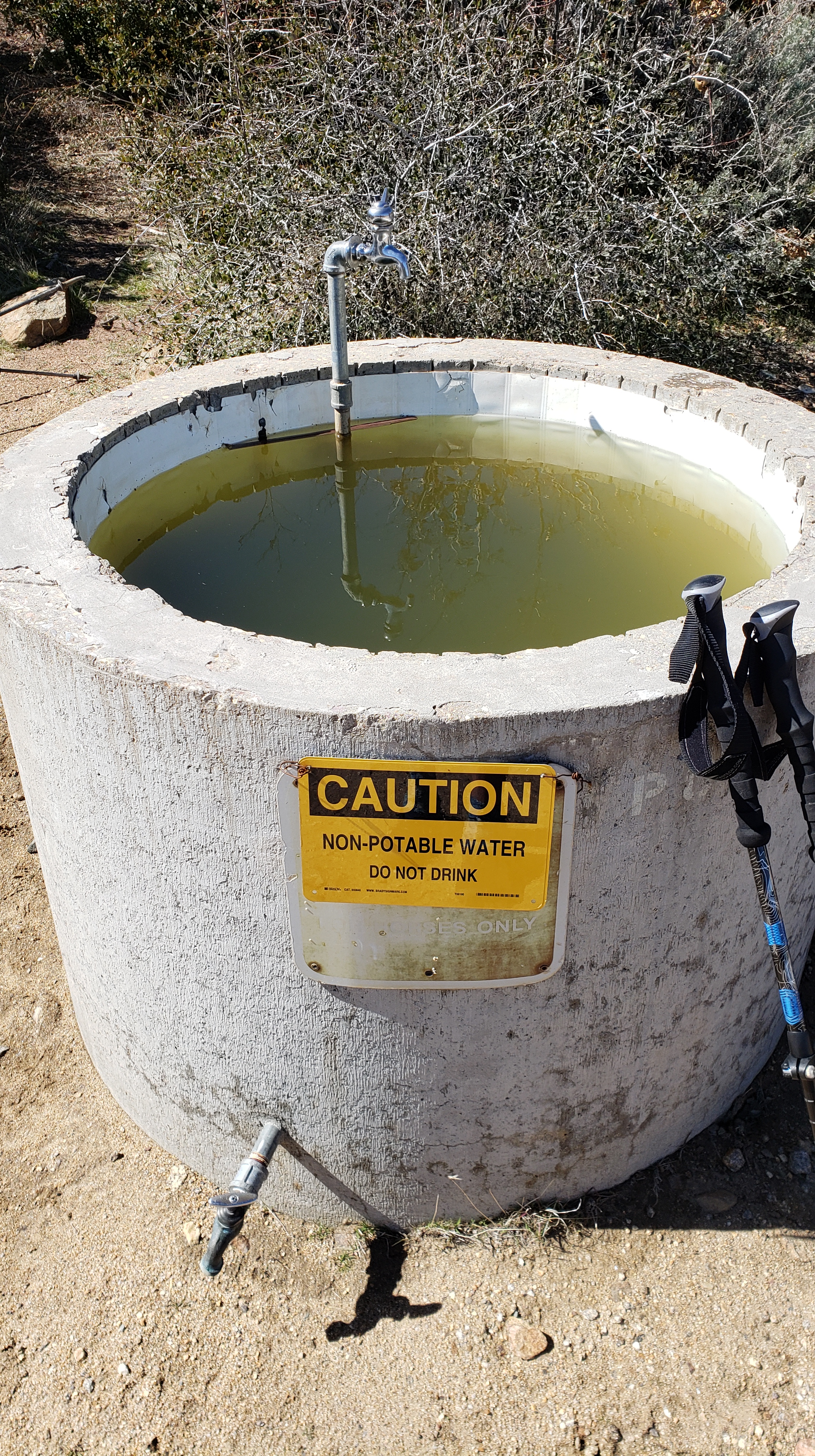
Along the way, our new friend explained that she was out scouting water locations in preparation for her coming thru-hike attempt in March. She seemed cool and nice enough, so I asked if she’d be willing to drive us a bit further up the road, to Barrel Springs. Though it’s 34 trail miles between there and Scissors Crossing, it’s only a fifteen-minute drive. She agreed and turned up San Felipe road when we hit the crossing, dropping us off right at sunset at mile 101.5, Barrel Springs. We said our many thanks and bid her farewell, hurrying into camp to set up before dark.

Despite the setbacks, we’d accomplished the best possible plan, all before dark, at that. We couldn’t believe our luck, laughing repeatedly at the ways the trail provides as the stars came out above the tall oaks surrounding the dry riverbed upon which we camped.

Late in the night, or early in the morning perhaps, the wind began tearing above the trees. A few stiff gusts found their way into the sheltered little canyon in which we camped, but judging by the horrible roar above, we avoided the worst of it. In the morning, I checked the local weather, and found there was a High Wind Warning for the area, with sustained winds of 30+ miles per hour and gusts of 50+, including gusts in the early morning hours of 90+ MPH.

Had we been camped at the RV Resort, which is in flat, open desert, or at Scissors Crossing (similar), we would have had a miserable, potentially dangerous, night. Instead, it was a little breezy, and my friend’s rainfly blew off a bit because he’d staked it in loose sand without weighing it down. Overall, not much to worry about. The magnitude of our luck became fully apparent that morning as the wind raged above.

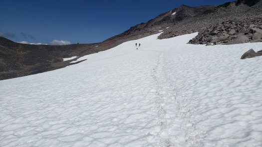
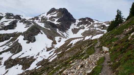
The wind advisory continued for the next 36 hours or so. We talked about the risks of camping in the exposed mountains between miles 101.5 and 77 with the potential strong winds and decided against risking it. Both of our bodies were fairly worn down at this point as well, with neither of us in the shape we had hoped to be in for the hike. We decided to hike the five or so miles to Eagle Rock and back that day, and camp in the same place at Barrel Springs a second night. The next day, we could walk thirteen miles along the road to get back to Scissors Crossing, by which time the wind would have calmed and we could camp at the RV Resort, which happens to be a stop along the bus route to El Cajon Friday morning.

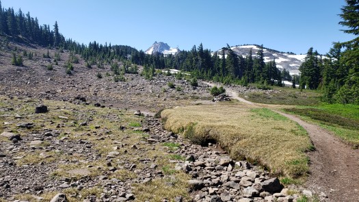
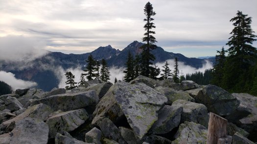
That morning we hiked out to Eagle Rock through the meadows outside Warner Springs. The breeze was strong at our backs on the way out. A herd of cows had decided the trail would be a nice place for a morning graze, so we circumvented the lumbering ladies as their gaze followed us around their little gathering. Once at the natural monument, the wind tore through with renewed ferocity. We meandered around the pile of rocks a bit before turning back the way we’d come.

20200226_092212.jpg

20200226_093447.jpg

20200226_093506.jpg

30-40 mile per hour winds bore down on us from ahead as we made our way back. It was exhausting work to push through the meadows that morning against the gale, like wading through chest-high water. By the time we returned the five miles to our sheltered campsite at Barrel Springs, we were both drained and sore, the week’s hiking catching up to us. We spent the afternoon lounging in the sands at Barrel Springs, grateful for an afternoon to relax and recover.

IMG_1011.jpg

We walked out to the road as the sun began to set in our little valley, the chill of desert night following behind the sinking daylight. The road would provide a few extra minutes of warm radiance to soak in before layering up for the long night. A U-haul truck was parked in the small lot off Montezuma Valley Road, bearing an advertisement attached to its rear. CONGRATULATIONS PCT HIKERS ON 100 MILES, it read. Below that, a little market’s wares were flaunted, including beer, chips, cigarettes and ice cream. CALL FOR POSSIBLE RIDE/LODGING, the sign read. A quick Google showed the place to be open for another hour or so, so I hopped on the phone and asked for a quick ride to pick up some beer and snacks for the evening. Five minutes later a woman in a flashy new Nissan coupe arrived and whisked me away a few miles down the road to her little market, where I grabbed a few 24oz cans of Modelo, a pack of smokes and a large bag of Doritos.

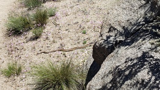
On the ride back I was advised by the proprietor and her male companion that there are loads of big cats in these hills, and that some mountain lion had now claimed two cyclists near Los Angeles as dinner, and had I seen any of these? Bears, maybe? No, I said, never seen a big cat or bear on the PCT in over 1500 miles. They seemed disappointed that I lacked any harrowing tales to share. I did see a tarantula’s ass as it skittered into its burrow last year but decided not to mention it. The four—count ‘em, four—rattlesnakes in total last year didn’t seem worth bringing up, either. I get the impression that rural SoCal residents hold some measure of pride for the supposed deadliness of their local terrain and fauna. Like many things in California, it doesn’t make much sense to me.

That evening, just before dark, a pair of PCT hikers rolled into the large campsite. We had seen a handful of names in the days before us in the trail register in Campo, so it made sense to finally see some of the people to which those names belonged. The pair of guys were perfectly asocial, barely bothering to return a raised hand in greeting.

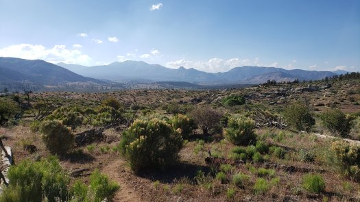
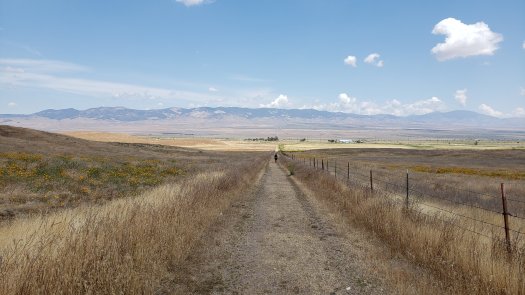
We were slow to get going Thursday morning, with only a thirteen-mile road walk ahead. We were off just before 8, walking the mile up Montezuma Valley Road to turn onto San Felipe and head south back to Scissors Crossing. We tried and failed the first couple miles to hitch as we walked, then eventually decided to enjoy the road walk for what it was and make the miles under our own power. The west side of the road eventually opened up to provide a sweeping view of meadows and mountains beyond. Under a partly cloudy sky with a pleasant breeze, we made the road miles quickly and enjoyably.

20200227_095055.jpg

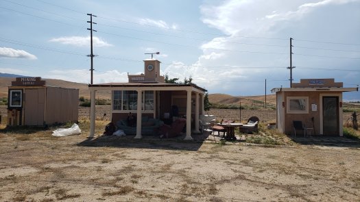
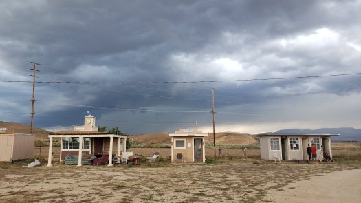
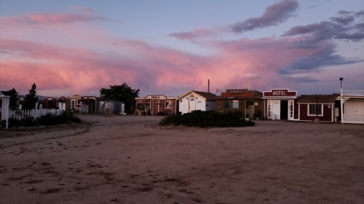
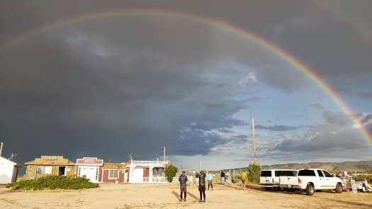
With just a mile or so to go, a minivan pulled off the side of the road next to us, asking if we needed a ride anywhere. I quickly recognized its driver as a trail angel who’d given me a ride last year, and so we clambered in, getting driven to the RV Resort one last time. Ghost is a kind man with a grizzled beard who spends a few months each year helping fledgling PCT Hikers on their way through the Scissors Crossing/Julian area. He dropped us off at the RV Resort, where we got a hot lunch and paid for a campsite.

The afternoon was spent going through our gear and supplies, tossing any collected garbage that had stowed away in our packs during the week. We did some laundry in a facility with too many signs bearing stern instructions for any of them to mean anything and generally lazed about on our last day in the desert.

Friday morning was cold and cloudy. We waited out front of the RV Resort along the old stagecoach route, craning our necks to see around the distant corner at the sound of any engine humming its way up the hill. An old man wandered out from the RV Resort to the road’s edge, old flip-phone in hand, complimenting us on our apparent knowledge of the bus schedule despite one not being posted at the bus stop. He then turned west and wandered into the chaparral and cactus of the desert, disappearing below the chamise without a word.

The bus arrived ten minutes late. We joined four men already riding its long route from Borrego Springs to El Cajon. Unlike the city bus that took us out to Campo a week earlier, this rural bus was a shorter bus with forward-facing seats that actually bore a modicum of cushion and comfort. While one of the men was silent beside his large piece of luggage the whole journey, the other three were engaged in a lively discussion, one we walked in on the moment we boarded.

The conversation was so scattered and bizarre that to try to capture its full essence here would be nigh impossible, though a part of me deeply regrets not transcribing any of it in the moment. Some highlights as best I can recall:

A lengthy discussion on the merits and individual preferences of each man regarding berries.

An insistence by one man that the British stained their teeth with tea to avoid decay, leading to full—though brown—smiles. (Intrigued, I later researched this and found no evidence of the British doing it. However, it used to be very prominent in some Asian cultures, and still occurs in some—though tea is not the dye of choice. https://en.wikipedia.org/wiki/Teeth_blackening)

Well my family was military. Moved around a lot.”
“You were military?”
“My family. Dad was. I guess I didn’t really know him. Apparently, he and my mom never were close. You know what people do.”
“Mmhmm.”
“So, they did that and here I am. It’s fine. I know my cousins.”
“Your cousins? What about your parents?”
“Don’t know. It’s great. Don’t have to worry about it like most people.”

A theory on the once-prominent geysers around Palm Springs, CA, and the government’s supposed “capping” of them.

They’re welding the doors shut if you have a cough or fever. Chinese communists… they’re literal gangsters. The people are getting tired of it. They’re not going to last for long.”

All three men becoming incredibly interested in the wild turkeys roaming the mountains near Julian.

Well, I’m really good at most things, just never found my potential, you know.”
“Oh, what were your best subjects?”
“Natural sciences. Medicine. Forensics, man. If you needed any sort of help with forensics, I’m your guy.”
The third man, who didn’t say much, wearing a pair of clear protective eyewear as he sat on the comfortable red faux-leather bus seat beside his few worn bags of belongings, nodded knowingly at this.
“Ooh, I was awful at chemistry. Got a C.”
“Yeah, I mean, I wasn’t about the grades. I went and took the tests at college but wasn’t enrolled. They never gave me a degree or anything, but I’m smart.”
“Forensics you said?”
“Sure. You know, a crime scene. Say they don’t know where the guy is. But if you look at where someone lives, you can get an idea. You find a piece of clothing or something, it has a smell. The bacteria, you know. I can follow that and find them.” Impressed nods all around.

We arrived in El Cajon around 10:30 AM. The day was hot in the valley, easily 80 degrees under the blazing sun. My friend was off to Los Angeles to continue his vacation a few days longer and visit family. I bid him farewell as he ascended the steps to the trolley platform while I headed into El Cajon toward the post office. I planned to send home the things they don’t let you on the plane with.

There are many homeless folks in the San Diego area, though each one I passed kept to themselves and did not ask for money. Perhaps my having the appearance and smell of having hiked for a week had something to do with this, but I was never accosted. Seeing two men huddle in the shade of a truck parked alongside the road as they searched for veins in their arms was a bit surprising in the late morning daylight, a reminder of the sheltered and privileged life I lead. I was thankful for my place in life as I walked by, wearing hundreds of dollars’ worth of high-performance hiking clothing, carrying well over a grand’s worth of gear on my back. I smoked a cigarette, aware that in most cities this would result in what I’ve dubbed the City Cigarette Tax, otherwise known as the inevitable request for a cigarette from someone down on their luck. I accept the odds on this and feel decent about myself for never begrudging those who ask—I freely give out smokes if someone wants one. A petty gesture of solidarity. No one asked that day.

A trolley ride, a few good tacos and a short walk later, and I found myself checking into another Motel 6, the nexus of pre-travel suffering. The walls were thin enough that I could hear every word of every conversation from both of my neighbors, along with what sounded to be a vigorous wrestling match from one room and a 3:30 AM wake up with blaring cable news from the other. If I ever stay in a Motel 6 again it will be against my will and likely the last moments before I am harvested for organs in a moldy bathtub. I was all too grateful to leave the room just after 5:30 AM to call an Uber for my early morning flight.

Going through security at San Diego Int’l was the most grotesque display of literal human herding I’ve seen in some time. Following my dealings with a painfully slow robot check-in booth (why they have decided to emulate in these the pace and apparent urgency of an actual airport employee escapes me entirely), I was ushered into a twisting, labyrinthine queue of miserable humans, snaking in rows between a CNBC store and some other overpriced hellhole before it vomited out in front of the doors to Terminal 2 where I joined its awful ranks as it continued to swell in the morning rush of travelers. This massive herd was separated by a somewhat functional walkway, on the other side of which two TSA employees occasionally waved across a couple dozen cattle to the next bit of line before the body and luggage scanners. I smiled some twenty minutes later at the horrified newcomers crossing the gap between the first herd and second, cautiously making for the open TSA PreCheck line before realizing that, no, they are not one of the Chosen Few, as they were cast to the end of the pleb line where it vanished into the ether, terminating perhaps somewhere out in the badlands of eastern San Diego County.

Another ten minutes and I was on The Other Side at last, and this line moved somewhat quickly. Within minutes I was bending over awkwardly to untie my shoes and assault any nasal passages unfortunate enough to be in my proximity. A week of hiking in the desert will make any pair of shoes stink, but particularly a pair that already has 500+ miles on them.

A father just before me was struggling with the terse instructions from TSA to deconstruct the stroller in which his infant son rested before going through security, and the line paused waiting on him. After finally removing the car seat and collapsing the stroller to place it on the conveyor belt along with a bucket of other baby gear, he went through the side with his son and the belt began to move again at last. The stroller got stuck trying to pass into the x-ray device, too wide to fit through. The older Hispanic TSA agent gave me an apologetic look as he removed it, and finally my own possessions went through. The TSA agent fumbled with the stroller to the side of the line, unsure of where it needed to go next, and I felt a twinge of sympathy for the man. We were equally miserable, after all.

There was a four-hour layover scheduled before my 45-minute flight home from SeaTac. I paid $44 and took the shuttle a half-hour after landing in Seattle instead.

PCT Days 106-111; The end for now.

20190726_103507

We left Stevenson and Cascade Locks on day 106. I had a slower start than Sunny and Inge, as I wanted to get an early lunch before leaving town. I hitched to the Bridge of the Gods and walked over officially this time, pack and all. I stopped at Locks of Dogs and Treats, an ice cream and hot dog shop in Cascade Locks. I had an awesome chili dog here, although it made the climb afterward tough as all I wanted was a nap. But the trail had other plans for me, as the climb out of Cascade Locks is brutal, well over 3000 feet and steep. I made slow progress, both owing to the heavy lunch I had, but also a sharp pain in my right toes. I hadn’t had this pain before, so it was slightly concerning and irritating. The day consisted of dense forest, both burned and not, with some decent views of Mt. Hood. We finished the day at Wahtum Lake, a popular destination for locals. It was a fairly short day, right around 17 miles, ending at mile 522.3, but the climbs made it a hard day.

20190726_15021720190726_16000320190726_171556

On day 107, our goal was Lost Creek at mile 550.6, 28.3 miles ahead. We were trying to set ourselves up for a short few miles the following morning into Timberline Lodge, where their famous breakfast buffet awaited us. The early part of the day was spent hiking through fog and light rain, mostly in dense forest. Eventually, the day cleared up, and as we approached Mt. Hood we had some fantastic views. The pain in my right foot persisted on this day as well, and while I had thought it to be in my toes the day prior, I was now sure that the pain was in a specific metatarsal. I reflected on what may have caused this pain, and I’m fairly certain it was from just a few miles prior to getting into Stevenson, when I stubbed my foot very hard on a stubborn rock. The acute pain that day had been in my right big toe, but that subsided by the time I was in town. It wasn’t until hiking on it a couple days later that the real injury made itself clear. I pushed through the pain and made the miles regardless. Mosquitoes were occasionally annoying throughout the day as well, including where we were camped.

20190727_08065420190727_17465720190727_17582120190727_182217

We set out in high spirits on day 108, ready for the breakfast buffet at Timberline Lodge. I made the miles fairly quickly, despite my foot aching and my headphones finally dying (one of the earbuds had died weeks ago). The scenery just prior to the lodge was fantastic, the trail wrapping around Mt. Hood and providing awesome views. I was surprised to see skiers and snowboarders cruising down the mountain in the late July morning heat, but as I made my way down to the lodge, it was clear that the ski season was still in full effect up here. Dozens of folks decked out in full snow gear made their way to the lifts past hikers in short shorts and t-shirts. The buffet was delicious, and I stuffed myself. After relaxing and charging electronics for awhile, we continued hiking. I hiked another 21.3 miles to make it a 26.4 mile day, ending at mile 577 at Timothy Lake. Sunny and Inge weren’t here – I assumed they hiked another few miles to the trail magic that was supposedly ahead. However, it was after 8 PM when I reached the southernmost campsite around Timothy Lake, and I decided to call it quits for the day there and camp by myself. I had a lovely evening by the placid lake, enjoying a small fire and some bourbon before calling it a night.

20190728_07052120190728_07053420190728_07532020190728_08110420190728_10203220190728_16312420190728_201815

The goal for day 109 was to make it to Olallie Lake at mile 607.1, where a small general store allows hikers to camp nearby. I set out a little late despite the 30 mile day ahead of me, as I had gone to bed a bit later. I got to the trail magic the girls had pushed for the night previous, where I enjoyed a beef and turkey sandwich courtesy of a lovely trail angel. I set out again through the woods, making the miles as quick as I could despite the persistent pain in my foot, as well as frequent pain in my hips. The day was often quite buggy, and I found myself growing bored and annoyed with the trail. I had been dealing with this boredom somewhat regularly for the last couple weeks, and combined with the mosquitoes, I was just frustrated. I was glad to see my friends when I finally got to camp, 30.1 miles later.

20190729_164017

On day 110, we were to hike about 26 miles, setting ourselves up to get into Sisters the following day at a decent time. The day was frequently extremely beautiful as we made our way up to and around Mt. Jefferson. The trail often made its way across open lava fields and meadows, with little alpine lakes and ponds dotting the landscape. However, despite being aware of the sublime beauty around me, I was again bored, annoyed, and in constant pain. At this point, I became fairly certain I had a small fracture in my metatarsal, as the pain had not subsided at all, and the area was not terribly swollen the way it would be if it were muscular or a ligament problem of the same severity. My hips were also giving me quite a bit of trouble again. The views were gorgeous, but often difficult to enjoy due to heavy mosquitoes. I limped into camp at mile 633 well after 6 PM for the fourth night in a row, and I was fairly convinced at this point that it was time to reevaluate the hike. As we hid in our tents in the evening, with dozens of mosquitoes lining the outside of my tent, I let my hiking companions know that it was potentially going to be my last night on trail. I checked my bank account and credit card balances for the first time in nearly a month, and realized something: regardless of my injury, boredom, or annoyance with mosquitoes, my finances were putting a hard stop to the hike. There was a number that I decided on before hitting the trail in April that if my account fell below, I would have to get off trail, and my account was just a hundred or so above that number.

20190730_07043720190730_07530520190730_08083820190730_08531720190730_10343020190730_10465320190730_10501720190730_10532820190730_11045820190730_11125620190730_122319

Day 111 would indeed be my last day on the PCT. There was about 19 miles to hike to get to Highway 20 at Santiam Pass, mile marker 652.2, where a hiker can easily hitch into Sisters or Bend. The last day was beautiful as we made our way south from Mt. Jefferson and around Three Finger Jack, approaching Mt. Washington and the Sisters. Alpine ponds and lakes were scattered throughout a lengthy burn area that provided excellent views of the volcanoes, as well as views out to the west and the coast and views out to the east and the Oregon desert. It really was a nice sendoff, a lovely last day of hiking, under sunny skies, with few bugs and easy-going trail. My foot and hips were killing me, but I took it all in with a fairly content, if not slightly melancholy, attitude. It was a bittersweet day to be sure. At the pass, there were a couple of locals making hot dogs and giving out beers to hikers, one last bit of trail magic. I enjoyed a beer and a dog before heading down to the highway to hitch. After about 10 minutes, a bright red vintage 1972 Corvette Stingray pulled up and gave me a ride – definitely one of the coolest hitches I’ve ever gotten. The car was in excellent condition and was really a joy to ride in, and its owner was a pleasure to meet as well. He dropped me off at the public campground in Sisters, where Sunny and Inge shortly met me. We enjoyed dinner together and drinks at the campground later in the evening.

20190731_06391820190731_06542620190731_07462520190731_07495620190731_08475020190731_09411520190731_10545520190731_10580920190731_13284420190731_145902

I had lunch with Sunny and Inge the following day before saying goodbye and wishing them well on the rest of their hikes. I was sad to leave them, having hiked with them for over 500 miles, but we all have to follow our own paths in life. I spent the day in Sisters figuring out how to get home, and hanging out with Moon Bite, a hiker I had seen periodically since the desert (he had also flipped). He too was ending his hike, and heading home to Portland. We both booked a shuttle for the next morning to Portland. I rented a car from PDX and drove home to Wisconsin (my preferred method of travel – I hate flying with gear and in general; train and bus are too slow). And here I am, resting and recovering, letting my foot and body heal.

Interesting things to note: I lost exactly 40 pounds, going from 192 to 152. I hiked a total of 1397.5 PCT miles, just over half of the trail.

So what’s next for Mellow? I’ll be moving to Oregon in the near future. The Pacific Northwest captured my heart, and Oregon in particular seems the best spot for me for now. I’m hoping to finish up the PCT in Oregon in sections in the near future, which shouldn’t be hard once I’m living in the area. I’d like to do the Sierra, the one section I’m quite bummed to have missed, soon as well, though it will likely not happen this year. As for other future hikes, I’d also love to do the Colorado Trail, although I’d likely take a few alternates to hit some bigger peaks along the way. The Arizona Trail is on my list as well, and I’d really like to spend some time in Utah.

Thanks for following along on this year’s adventure. I’m a bit bummed to not have hiked the whole trail in one go, but I was never terribly committed to doing so anyway. My purpose for hiking this year was to have fun, and once injury, boredom, and money came in the way of that, it was time to stop hiking. I’ll update in a few weeks hopefully once I’m in Oregon and a bit more settled. I’m in the process of rescuing a Subaru Outback to bring back to its native habitat of the PNW as well, so maybe I’ll post a couple of pictures of that cute thing sometime soon.

PCT Days 93-105

After a hiker’s share of beer and food, we ended up camping at the trailhead rather than hiking any miles. So early on day 93, we left Snoqualmie Pass, hiking up through the ski slopes that were covered in wildflowers. The trail continued on under a series of powerlines before heading through mostly forest, passing the occasional small lake. We camped on an unused dirt road at mile 281.8, a 22.3 mile day. The weather was pleasant and mosquito-free, so Inge, Sunny and I had a nice campfire and drank some Fireball whiskey before calling it a night.

Day 94 was sunny and decently warm, which made for a nice day of hiking. The trail provided many views of the rolling green mountains in the area as it climbed and descended all day. Despite having nearly no flat sections, the day was not bad as the trail was well-maintained and mostly dirt. A burn area near the end of the day was filled with wildflowers, a neat contrast. We camped near the Mike Urich cabin, a 23.8 mile day. Another fire was had, with Milk Jug, Blueberry, and Colleen the Machine joining us.

We awoke to rain on day 95. It rained basically all day, sometimes barely a drizzle and occasionally a near downpour. This meant few views, despite passing over open trail that almost certainly provides stellar views on a clear day. I kept my head down and headphones in, letting myself fall into an automatic state as I listened to audiobooks and podcasts to pass the time. We made it a shorter day because of the crummy weather, hiking 21.3 miles to Sheep Lake at mile 326.9. The same crew joined us at camp again, as well as Solo, although there wasn’t too much socializing on the wet and chilly night.

We had heard that the last ten or so miles leading up to White Pass were very buggy, so we prepared ourselves for another evening cooped up in our tents. It continued to rain on the morning of day 96, although it eventually cleared up and the sun poked its way out. Once it was clear, the views were lovely, the trail meandering through forest, meadows, and open ridges. The overall grade of elevation change was a bit less than usual for Washington, so I felt good as I hustled through the mosquito territory — an area filled with little lakes and ponds — near the end of my 24.9 mile day. I unintentionally startled an elk at one point, a large female that crashed through the thick forest as it ran away. She glanced back, looking majestic and annoyed. Camp at Buesch Lake was indeed overran with mosquitoes, so we all sheltered in our tents, despite the sunny and comfortable evening.

On day 97, we had just 6 miles to hike to get to White Pass. I got up early, around 5, to try to beat the mosquitoes, and managed to dig a cathole fairly unperturbed. By the time I was leaving camp around 6, the bastards were out in force. I made the miles easily, and got to the Kracker Barrel gas station (no relation to the chain of restaurants) at White Pass shortly after 8. Inge, Sunny and I decided to head into Packwood to avoid the rain that was coming, and so we booked a room at the Packwood Inn. An employee came to pick us up a little later, and by 10 AM we were in town. We spent the day eating and drinking, and especially enjoyed Taco Wednesday at the saloon.

We spent day 98 mostly in Packwood, having breakfast at the coffee shop and lunch at the saloon. While eating ice cream outside the grocery store, a nice older man offered us a ride back to White Pass, so we hopped in his truck with him and his wife and their sweet old German Shepherd. We had planned on hiking a few miles, but many of our friends were hanging out at the Kracker Barrel, having arrived that day. We decided to camp with them behind the gas station, and had an enjoyable evening drinking beer and catching up. The Goat Rocks Wilderness lay ahead, often called one of the best parts of the entire trail.
I was on trail just after 6 AM on day 99, eager to hike in nice weather through beautiful terrain. The forecast said the early morning clouds would clear by 10, which would hopefully lead to spectacular views from the Knife’s Edge section of trail near the end of the day. The trail ascended sharply from the pass, through dense but pretty forest. Eventually, the trail opened up to a large rocky face, and made its way up to a pass, and the first glimpse of the Goat Rocks mountains. The scene south of us was lovely, clouds tearing across the peaks as the morning sun drove them away. To the west, however, thick low clouds still hung, rolling over the ridge towards us only to dissolve in the warm sunlight. Inge and I decided to wait for the clouds to clear a bit before heading over the western pass. After about an hour, the clouds had mostly cleared, and we headed on. Rainier was visible though somewhat obscured with clouds, but still lovely to see. A brief burn area led to great views of the range ahead. A short while later, the trail reached alpine again, and climbed very steeply up towards Old Snowy Mountain and the Knife’s Edge. After rounding a tight bend on a steep rocky face, we emerged onto an incredible ridge walk, the trail cutting up the side of a steep rocky slope. As we progressed higher, we passed snowfields, the exposed ridge on which we walked mercifully clear. The views of the surrounding valleys and ranges were stunning as we climbed even higher, reaching the junction where the official PCT follows a stock-friendly route, whereas the old PCT traverses what’s known as the Knife’s Edge. A steep and brutal climb up unstable lava rock and glass-like sheets of hard slate awaited us as we took the alternate, which most hikers opt to do, as the view from the top was great. Mt. Adams, Mt. Rainier, and Mt. St. Helens were all in view, along with the surrounding mountains, layers upon layers as far as the eye can see. We made our way down to our campsite after crossing a brief snowfield. We camped at mile 376.3, just south of the Knife’s Edge — an 18.5 mile day, but a tough day regardless, due to unusually steep trail (for the PCT). The views were incredible from this alpine campsite, with Adams and St. Helens visible from my tent. Eventually, Slippy, Cloud, Jan, John Mayo, 6:30, Sprinkles, and Sara joined Sunny, Inge, and me, and we enjoyed each other’s company in the setting sun. A fog rolled in right before sunset, but I was still able to get some great views and pictures, one in particular of St. Helens at sunset.

Day 100 was a bluebird day, not a cloud in the sky as I rose early. I snapped a few sunrise shots before leaving camp, a bit sad that this incredible area would be ending already today. Some charismatic marmots posed for me as I passed, and some of the rock piles were unlike anything I’d seen before. The Cispus valley was pretty, still in the morning shade as the sun climbed the peaks. Once over Cispus Pass, the Yakima Reservation valley opened up before me. A short while later, another excellent view of Adams was had before the trail descended into the forest for the rest of the day. We camped near a field of lava rocks, where a spring gushed forth, filtered by the igneous rock. It was a 26.8 mile day, ending at mile 403.1.

On day 101, we had the opportunity to go into Trout Lake, where we could get burgers and beer. It was 20.5 miles to the road where one can hitch to the minuscule town, so I got going fairly early. The trail passed mostly through fairly buggy forest, occasionally opening up to grant awesome views of Mt. Adams and Mt. Rainier. After a few miles, the trail opened up in a sub-alpine area. The sun was shining, there was a decent breeze, and views all around, but the day was marred a bit by mosquitoes yet again. I made the miles quickly and got an easy hitch into town around 1:30. I vented my frustration with the mosquitoes to the girls over lunch, and decided to hitch to Bingen, WA to visit Margie’s Pot Shop to resupply on safety supplies. I caught a ride in about 5 minutes, as two nice women who were avid hikers themselves picked me up. A half-hour later I was at my destination, and after getting what I needed, I was on the side of the road again, thumb out. I got back to the trailhead in three hitches, waiting less than a half-hour combined. We had planned to do 5 more miles rather than stay in town. I made the miles quickly as we camped near Trout Lake Creek at mile 428.8.

Day 102 was Indian Heaven Wilderness, AKA the worst mosquito day in Washington. I knew this ahead of time, and so I spent the entire day in my wind pants and wind jacket, also frequently donning a bugnet over my head. It was hot but better than being eaten alive. Most of the day was not terrible, though around some lakes they got very aggressive. Blue Lake provided a nice breeze however, and I was able to enjoy lunch there before finishing up the day. The day was mostly spent in buggy forest, though we did get our first good look at Mt. Hood. We camped near a gravel road and trailhead, at the end of the Indian Heaven Wilderness. The bugs were thankfully not too bad at our campsite at mile 454.7.

The morning of day 103 was worryingly buggy as I packed up camp, but after a short cruise the forest opened up and the mosquitoes essentially vanished. I caught up to Inge fairly quickly, and we had a nice break at the top of the morning’s climb, enjoying another great view of Mt. Adams. We spent the next few miles stopping often to eat wild huckleberries off their bushes, many perfectly ripe. They were delicious, and it was hard to stay focused on hiking. The trail descended steadily for nearly ten miles down to Panther Creek, where we stopped for lunch. The long descent put us at only about 900 feet above sea level, and accordingly it was quite warm, easily in the 90s under the sun. I stripped to my underwear and laid down in the shallow snowmelt creek, which was icy cold but incredibly refreshing. After having lunch and drying off in the sun, I finished the hike through the forest, camping at another unused dirt road at mile 480.2, a 25.5 mile day.

Day 104 would be the last hiking day in Washington. We had 25.3 miles to hike to get to the Bridge of the Gods, which spans the Columbia River and crosses into Oregon. There were a few nice views after the big climb of the day, but otherwise the day was spent mostly on cruisy trail through the woods. As I descended towards the Columbia and therefore sea level, the temperature soared and it felt sweltering under the sun. I made it to the highway and quickly got a hitch into Stevenson, where Sunny, Inge and I had a hotel reserved for the next two nights. We did laundry and showered before getting beer and snacks at the grocery store, and tacos from a taco truck. We spent the rest of the evening relaxing at the hotel.

Today is day 105, and it’s a zero day in Stevenson. I got an awesome breakfast roll at a nearby espresso hut — a sourdough roll stuffed with bacon, sausage, potatoes, onions, peppers and cheese, grilled with crispy cheese sealing the top. It was as good as it sounds. I got my beard trimmed at a local barber before getting a new hiking shirt at the thrift shop and resupplying for the next six days at the grocery store. We plan on heading into Cascade Locks, across the bridge, later today to claim a couple supposedly free beers at local breweries. There’s a bluegrass festival in town starting tonight as well, so we might check that out as well. Oregon awaits!

PCT Days 83-92

We left Stehekin on the first bus out on day 83. The Red Bus runs from Stehekin proper up to the High Bridge Ranger Station, where the trailhead is. It stops at the Stehekin Pastry Company on the way, where I picked up an excellent Raspberry Hazelnut roll. We started hiking at about 9 AM, planning to head to a campsite 19.5 miles away, near the top of the 20 mile climb out of Stehekin. After a short bit of hiking, I entered Glacier Peak Wilderness. The trail wound through dense forest at first, making its way up through the valley. A crew of Forest Service workers passed by, carrying saws. This was nice to see, as we had heard that there was a section with tons of fallen trees across the trail. Hopefully this meant that section would now be clear. I had some nice views on the climb up. We camped at a large meadow, which unfortunately was somewhat flooded and therefore buggy. A small smoky fire helped deal with the annoying mosquitoes. The goal for the next day was 23.1 miles away, at mile 123.3.

The morning of day 84 quickly turned overcast. After cresting the climb near Cloudy Pass, the trail descended and began to get very overgrown in segments. It was July 4, and I was anxious — the previous two July 4ths, I’d had a migraine. I’m not often superstitious, but I’d be lying if I said that I wasn’t concerned. The trail was somewhat boring for parts of the day, though one section of forest contained absolutely massive trees that were neat to hike near. As I neared the day’s goal, the trail finally opened up again for a few miles, providing striking views. I reached the planned campsite before 3, and when Sunny and Max passed by and said they were going on, I chose to continue as well. After a bit, the dense brush returned over the trail, but when I made it to Milk Creek, I decided to push on and do the next climb to the base of Fire Creek Pass at Mica Lake. I made it to Mica Lake around 6:30 PM, just over 12 hours after starting. The site I camped at by Mica Lake is at mile 131.9, making it a 31.7 mile day, by far my longest yet. The beautiful, still mostly frozen alpine lake was a fantastic reward, though the mosquitoes were a bit pesky.

I slept in a bit on day 85, having felt that I earned it. The girls rolled past Mica Lake as I was packing up — they had camped 4 miles earlier near Milk Creek. They were planning on a campsite at mile 150.6, only 18.7 miles from where I was. Still, a shorter day sounded good after the previous day, and the only potentially sketchy snow that we had left was coming up. A heavy fog that covered the pass above broke just after 7:30, and I set off. Fire Creek Pass was the first alpine pass in awhile, and it was beautiful. There was a bit of snow — a moderate snowfield before half-covered switchbacks, then a couple moderately steep traverses. The trail, once over the pass, then made its way back into woods for a time. As I headed back up, this time to Red Pass, the scenery opened up again to a stunning granite landscape, with small grass and shrubs providing some green against the imposing rock. Streams snaked all over, and a intermittent fog rolled over the nearby peaks. The mood here was nearly tangible, a gloomy yet surreal beauty about the land. On the south side of Red Pass, two steep snow traverses awaited, which I crossed without issue. Shortly thereafter, a heavy fog obscured the nice view. However, two marmots came out, and began tussling on the trail. This was incredibly adorable, particularly when one conceded defeat and was chased all of 20 feet down the trail. Finally we reached a crowded but spacious camping area, where hordes of weekend hikers were out, presumably having a long holiday weekend. It rained in the evening and on and off all night.

On day 86, the plan was to at least make it to Grizzly Peak, 23.4 miles ahead. The morning was very foggy again, obscuring what were likely great views on the ridge walk to start the day. The trail passed through forest for much of the day, with the occasional boulder field breaking up the monotony. I listened to audiobooks most of the day and it passed the time easily enough. At Grizzly Peak, as expected, the girls had gone on. I got there around 4, meaning they had been there an hour earlier probably, as they get started earlier than I do most days. I took a short break and continued on another 3 miles, where I met my companions at a small meadow campsite at mile 177.1, a 26.5 mile day complete.

Day 87 was the day we arrived at Stevens Pass. We had just 11.3 miles to town. I left camp around 5:30, early for me, and made the miles relatively quickly. We hitched into Skykomish from Stevens Pass, set on going to the Cascadia Inn and Cafe for their Sunday breakfast buffet. We arrived just before 10:30, anxious we may have missed it, but found that they ran the buffet until noon. We stuffed our faces — I had three heaping plates of scrambled eggs, hash browns, bacon and sausage. For $12, it was a great deal. After grabbing some drinks at the gas station, we hitched another 8 miles down the road to Baring, where we planned to stay at the Dinsmore’s. Jerry and Andrea Dinsmore started hosting hikers nearly two decades ago, converting a portion of their large garage into an 8-bunk hiker hangout, with couches, a fridge, kitchen equipment, a TV and a good selection of movies. They also built a small shed, half of which has laundry and loaner clothes, the other half, a bathroom with a shower. Sadly, Andrea passed away a couple years ago from cancer. Jerry himself is fairly immobile, so it’s up to the hikers who come through to keep the place running. Jerry is a kind, funny man, who is gracious enough to let hikers continue using the wonderful Hiker Haven that Andrea typically ran. Hikers keep the bunkhouse and other facilities clean, do laundry to ensure future hikes have towels and clothes to use, and donate a little cash to keep the lights on and water running. We set up our tents in the yard, as all the bunks were already claimed. We spent the afternoon doing laundry, taking showers, and relaxing. A few more hikers rolled in throughout the day, and the night was spent around a campfire.

On day 88, I took a zero at Dinsmore’s Hiker Haven. We hitched back to Skykomish in the late morning to get lunch at the Sky Deli and Pizza. I had a 14″ pepperoni and pepperocini pizza and a large Death by Chocolate milkshake, both of which were superb. I brought back a third of the pizza for dinner. We hitched back to Baring and I put together my snow gear — ice axe, microspikes, snow baskets for trekking poles — boxed it up and went to the small post office outpost in the general store in Baring to send it home. I should no longer require snow gear of any kind this year. We had another fire, roasted some marshmallows and enjoyed the peaceful evening.
We hitched back to the trail around 8 AM on day 89. I picked up and sorted out my resupply, then hit the trail. Stevens Pass is a ski resort, and so the trail wound its way under ski lifts as it climbed out of the pass. Mosquitoes were out in force, preventing any sort of meaningful break. The trail passed a handful of idyllic alpine lakes as it snaked through the forest toward Trap Lake. The ascent up Trap Pass was tough, but the view of the lake was phenomenal. Pieper Pass lay ahead, a massive pile of shale running up to imposing black peaks. These peaks loomed above the valley, afternoon sun just showing behind a gray sky. This pass was steep at times as well, but about halfway up, an incredible view of Mt. Baker came into sight. The mountain was breathtakingly huge on the horizon, towering over the nearby ranges, peak in the clouds. After crossing the pass, I hurried past the beautiful but very buggy Deception Lakes and made camp at mile 207.9, a 19.5 mile day.

Day 90 was to be a 22.2 mile day, to a campsite shortly before a protected fragile area, in which camping is prohibited. The day was typical for this area of Washington: a mix of forest and ridge walks, clouds and fog at times, and constant elevation change. There were several fantastic views throughout the day, and a couple tough water crossings that had me walking with wet feet. Having wet feet is fairly normal in Washington however — if not from frequent stream crossings, then from mud, or the trail flowing like a creek, or most commonly, from what Sunny has dubbed the “car wash”. The trail is regularly covered in overgrowth, and when there is condensation or rain on the brush, it gets a hiker soaked; thus the “car wash”. The day was filled with mosquitoes yet again, although I found respite in a few breezy places. Unfortunately, our campsite at mile 230.1 was laden with the little bastards, so we hid in our tents all evening, barely daring to crack the bugnet enough to reach a hand out and stir a pot for dinner. It started pouring at one point in the evening, which was fine, as it had been forecast to rain all day and had held off until that point.

The morning of day 91 started out misty and buggy. Trying to do one’s morning business while being swarmed by mosquitoes is not very pleasant, I can unfortunately report. I quickly packed up and made my way out of the hellish mosquito territory, over a ridge and into the lovely protected area. Alpine streams snaked through delicate grasses, ponds dotting the foggy but clearing landscape as the sun did its best to shine through. The trail then descended a seemingly endless switchback, with mountains across the valley providing excellent scenery along the way. The clouds wrapped around the peaks as they blew by, and a gentle breeze helped ward off mosquitoes. Once in the valley, a sign at a junction suggested an alternate for stockmen, as a bridge ahead was out. Sure enough, at Lemah Creek, there was no bridge, and a ford was required, at one point nearly thigh deep and fairly swift. Having crossed without incident, I was yet again resigned to hiking with wet feet. The climb out of the valley went through an old burn area, the dried out husks of old dead giants looming above. Frequent trees across the trail made this section frustrating at times, though the view was tremendous, particularly of Spectacle Lake and its surrounding mountains. After passing a few alpine ponds, the trail began a climb on pure shale. As it turned out, almost the entire next 5 or so miles were on shale, on the sides of steep slopes. This was quite painful on my wet and already sore feet, and by the end I nearly had tears in my eyes. My shoes are not very well cushioned, which typically is something I like for long distance hiking as it forces one to be more cognizant of one’s steps. However, this pair is at its life’s end, with over 500 miles on them, and after miles of unstable, sharp rock, I was wishing for something with a bit more cushion. We camped at Ridge Lake, a cute alpine lake with excellent views. Unfortunately, intermittent drizzle and pesky mosquitoes kept us in our tents most of the evening yet again.

Today is day 92. I had just 7.2 miles to hike into Snoqualmie Pass, and so I slept in a bit and got a late start, around 7:30. I quickly came upon the Kendall Katwalk, a famous section of trail that was dynamited out of the side of a steep cliff. The result is a small stretch of trail that is absolutely breathtaking, with incredible views of the surrounding mountains. After crossing this, the trail rounded a bend and Mt. Rainier came into view. The massive peak, at 14,411′, dominated the horizon, jutting far above every other mountain. From this point on the trail, the peak of Rainier was 45 linear miles away, making its presence all the more impressive. Around this time, I also passed a stone “1000” written out on the side of the trail, which confused me at first, and then I realized: this was the 1000 mile marker for anyone who flipped up from Lone Pine, myself included. I didn’t feel too much of a sense of achievement at the time, with over 1600 miles to go. Still, in retrospect, it’s a big milestone. The trail then descended into the woods the rest of the way, and my progress was regularly though pleasantly interrupted by day-hikers who wanted to chat a bit. I finally got to town around 10:45, and shortly thereafter enjoyed a delicious fried rice from a food truck called Aardvark Express. While eating, a woman with a serious hippy vibe sat nearby and we started talking. Calling herself Mayhem, she offered me and my friends a ride to her apartment, where we could do laundry and shower. This was unexpected and greatly appreciated, as the only place to do those things was by staying at the overpriced Summit Inn, which we planned to avoid. We’re hanging out at her place now, with the plan to head back to the pass later, get dinner and beer at the brewery, and hike a couple miles out. We’ll be getting to White Pass in five or so days, where I have new shoes waiting for me.

PCT Days 76-82

On the morning of day 76, we got a ride from the trail angel in Bellingham to Sedro-Woolley, one of the first towns along State Route 20 heading east in northern Washington. From there, we were assured it was an easy hitch for the last 2.5 hours to Mazama. We put our thumbs out and after a short while, a nice elderly lady gave us a ride to Concrete, about 30 minutes down the road. It took about 15 minutes to get another ride out of the small gas station in Concrete, from a young mother who was picking up her daughter at Diablo Lookout, another hour or so down the road. After getting to Diablo Lookout and enjoying the view, we started trying to hitch again, but this last one was more difficult. As time passed, storms moved in, and it began to pour. Lightning crashed around, and a bolt hit a tree on the mountainside, bursting into a fireball. It was pretty spectacular to witness, despite being outdoors in those same conditions. Finally, after 2.5 hours attempting to hitch, a young couple, both middle school teachers, took pity and gave us a ride to Mazama. We spent the night at Ravensong’s Roost, and prepared to head up to Hart’s Pass the next day. Rain was in the forecast for the next few days, but we were too antsy to start to wait any longer.

We walked to the cute general store in town before 8 AM on day 77, grabbing breakfast. We then stood roadside and put our thumbs out, one last hitch to get to Hart’s Pass. After a half hour or so, a former thru-hiker named Ironman and his wife gave us a ride up. It was a rough, at times nerve-wracking 45 minute drive up to the pass, but we made it in one piece, and for the time being, the skies were clearing. I spoke briefly with Broken Toe, a former thru-hiker who was doing trail magic for SOBOs. I then finally hit the trail again, heading north towards the border from Hart’s Pass. The view was partially obscured by clouds as I made my way, but what scenery was visible was fantastic. The miles passed easily and enjoyably, though it began raining after awhile. By 3 PM, the rain was really coming down, and as I made my way up Rock Pass, thunder sounded nearby. I reached a campsite with some trees and took some shelter, waiting to see if the storm passed. After not hearing any thunder for maybe fifteen minutes, I started heading up, when after a quarter mile a bolt of lightning struck rather close, only a 4 second count before the thunder came. I hightailed it back to the campsite with trees, and as the thunder continued and the rain turned to sleet, it became clear that setting up camp was the only smart option. I made it 15.9 miles from Hart’s Pass, 14.7 miles to go until the border.

The morning of day 78 was chilly and mostly cloudy, the sort of clouds that linger after a day of storms, like a hangover. I made my way over Rock Pass and up to Woody Pass. From Woody Pass, it’s a nearly 3000 foot descent to the border over 11 miles. I stopped at the gorgeous Hopkins Lake for lunch before trudging through four miles of overgrown trail and blowdowns. I tagged the border just after noon by myself, dramatic peaks surrounding the clearcut path that defines the border. After enjoying some sunshine, I began heading south, back up the same way I came down. Of course, it started raining again, though by the time I got back to the lake, the rain had stopped and the sun was peaking through occasionally. I was soaked from the rain and wet undergrowth, so I took another rest at the lake and dried out a bit. I headed up the last five or so miles back to Woody Pass, enjoying unbelievable views that had been obscured by clouds in the morning. I camped just south of the pass with Dreamwalker and a new friend from Canada, Inga. I had hiked 26 miles total, 11.3 south from the border. I’ll likely just be using Southbound mile totals going forward; to know my total PCT mileage, just add 745.3 to whatever the SOBO mileage is.

I got going a little late on day 79, just after 7 AM. In northern Washington right now, the sun rises at 5 AM and sets after 9, so there’s very little darkness each day. I continued to retrace my steps back to Hart’s Pass, taking in all the views I missed on the first day from clouds. The morning was clear and warm, and the miles went by in a flash. Rain rolled in again around 3 PM, so when I got back to Hart’s Pass and Broken Toe’s trail magic, complete with bonfire and tarps covering the area, I relaxed for awhile. I chatted with some SOBO hikers just starting their journey, and enjoyed a cup of mint tea. Finally, just after 5:30, I left to do the day’s remaining 6 miles. A pass along the way gave a tremendous panaromic view of the Cascades. I sat for a bit, the evening sun warming me as I took in the view. I finally got to camp around 8 PM, but still had ample time to set up camp and have dinner before it was dark. I hiked 25 miles to mile 36.3.

On day 80, my right knee started giving me some pain, which slowed me down a bit. I decided to do a few less miles, so the goal was at mile 57.7, 21.4 miles away. The morning was clear, though chilly as the first chunk of miles was in the shadow of the mountains. After getting down to and past Glacier Pass, we went up to Methow Pass. The view was fantastic, though dark clouds loomed in the far distance. The trail skirted the mountainside as it went toward Cutthroat Pass, a steep drop on the right of the trail for miles. As we reached Granite Pass, at the base of the sharp ascent up to Cutthroat, thunder sounded from just over the pass ahead. I decided to wait it out and take cover under some smaller pines, knowing the pass and ridge ahead were very exposed. Inga joined me as we hid in a cluster of pines, trying to gauge the storm’s progress. After an hour and a half or so, the storm had passed, so we began to climb the steep, sharp switchbacks that lead to Cutthroat Pass. The weather held off thankfully and we were able to cross the pass uneventfully, though the views were outstanding yet again. We set up camp before 6, and with so much daylight left and some pesky mosquitoes, we collected some wood for a fire. It was a nice night, and the first time on the PCT that I had a fire. We had 23 miles to hike the next day to get to Stehekin.

The first miles of day 81 were pretty cold, as the sun hid behind the mountains in the early morning. My knee was still giving me trouble, especially going downhill, which was unfortunate, as the 23 miles to Stehekin involved over 6000 feet of descent. After crossing route 20 and Rainy Pass, the trail passed through thick woods and deep brush. The sun rose above the mountains and heated the valley, and temperatures were much hotter than the previous days. The sun baked the condensation off of the heavy underbrush, making it so humid in places that it was difficult to breathe and truly felt like a sauna. The day went fairly slow for me as I struggled with my knee. I caught up to Inga with about 5 miles to go, so we hiked the rest of the way down, chatting about typical hiker topics: weather, gear, snakes. I mentioned that I had heard about a hiker seeing a rattlesnake in northern Washington, and not ten minutes later, a rattlesnake crossed the trail in front of me. It was very docile and gave only a cursory rattle as I approached. After it slithered off the trail, we finished the hike down to the High Bridge Ranger Station, where we would have to wait for the bus to town. Having arrived around 4 and therefore missed the 3 o’clock bus, we had to wait until 6:15 or try to hitch. After just a few minutes, an older couple walked up to a parked truck nearby and kindly gave us a ride to town. Stehekin is a tiny resort town, owned by the federal government as part of North Cascades National Park. There are no roads into town; the only way in and out is by ferry, seaplane, or trail. There are a few roads in town and a few cars. We got some beer at the general store and set up camp at the free campground in town, ready for a zero.

Today is day 82, and I’m enjoying a day off in Stehekin. I had a nice omelette this morning at the restaurant, and then did laundry and picked up my resupply box from the post office. Now I’m just relaxing as it rains yet again, thunder sounding in the mountains surrounding Stehekin and Lake Chelan. Thankfully the weather looks much better tomorrow and for the next week. We’ll be entering Glacier Peak Wilderness tomorrow, likely to be the last snowy section that I’ll have to hike on this trail. The elevation profile looks challenging for the coming days, but the scenery is supposed to be spectacular.

PCT Days 68-75

I spent days 68-71 continuing to wait in Bishop for my tent, doing work for stay and just relaxing. I had to buy food resupply for all of Washington, as there aren’t many good places to get groceries near the trail. This worked out to 25 days of food, which was a bit overwhelming to shop for all at once. After getting it separated into 5 piles, I mailed out 4 of them and packed the last into my backpack for the first stretch in Washington.

As the week went on, two other hikers expressed interest in flipping. When my tent finally came in on day 71, we finalized our plans for the following day. We reached out to a trail angel in Bellingham, WA who had posted on the SOBO Facebook group that hikers could stay there before getting a ride to a place that’s easy to hitch from to get to the trailhead. So we needed to get from Bishop, CA to Bellingham, WA. Our plan: hitch the 3.5 hours from Bishop to Reno; rent a car in Reno and drive to Seattle, spending a night in Eugene, OR to break up the 12-13 hour drive; drop the car in Seattle and take a bus to Bellingham. Because of the high cost of one-way car rentals, we needed to get the car from Reno to Seattle within 24 hours, which put us on a fairly tight schedule.

We left The Hostel California right at 8 AM as planned, packs full and a sign reading “Reno” in hand. Sunny, Dreamwalker and I made our way down 395 for about a mile before reaching the supposed ideal spot to hitch out of Bishop, where the 6 splits off and the 395 leaves town. After about 15 minutes, a nice woman and her 11 year old son stopped and said they were going to Mammoth, about 45 minutes up the road, and they could at least get us that far. We agreed and hopped in. The woman was from near San Diego, and had sectioned the first 80 miles of the PCT before. She was very excited to give hikers a ride, which was nice to hear. She dropped us off at the bottom of the offramp leading to Mammoth, so we crossed the street and started walking up the onramp, sign in hand and thumbs out.

We didn’t even make it to the top of the onramp before a late model Dodge Challenger pulled over, which was a surprise — you typically don’t get rides in nice cars. The man driving said he was going to Carson City, nearly 3 hours up the road and just shy of Reno. We gladly took him up and piled in to the sleek black sports car. As he shot onto the highway, our kind stranger explained that the car was a loaner while his Jeep was in the shop, at the dealership in Carson City. This made a lot of sense, as per what I mentioned earlier. The drive passed uneventfully as we made our way through the beautiful landscape. Lake Mono in particular was striking, and our driver explained that as a closed lake system, the lake had become salinated, and the only aquatic animals it supports are brine shrimp. The shrimp are an excellent food source for migratory birds, making the lake a vital stop on their journeys. There was a whole legal battle after Los Angeles diverted some of the water, and after a prolonged fight, the lake received protection and money from LA for recovery efforts. Decades later, the lake has yet to fully recover. It’s an interesting topic to read a bit more about, as a cautionary tale of the cost of unsustainable urbanization. We arrived in Carson City around 11:30, and were dropped off near the freeway onramp toward Reno.

We didn’t have to wait more than 20 minutes before a pickup with a fit older couple and a cute dog stopped and offered us a ride the rest of the way. We tossed our packs in the back before climbing into the backseat of the truck. We quickly got to Reno while hearing about how lovely Carson City and Reno are to live in — to be fair, Reno looked pretty nice. We thanked our last good samaritans and headed into the terminal to the car rental counter. After a long line and another long wait, we were finally in a Toyota Corolla around 1:30, heading north. We got to Eugene around 9 PM and settled in at our hotel room.

We hit the road at 7:30 AM, needing to return the car before 1 PM. The drive up interstate 5 was frustrating at times but went by without incident, and we got the car back with time to spare. We caught the shuttle to the Seatac terminal, where we hopped on the 1 PM bus to Bellingham just before it left. We arrived just before 4, and bought some groceries for the next few days. Shortly thereafter, our trail angel picked us up and brought us to the hiker hangout. The house belongs to a local musician who is visiting Europe for a few weeks, and has left his home in the hands of our host, for hikers to use before hitting the trail. We’re also helping look after his dogs, which is fun.
We’re currently on our third day here as we wait out some heavy rain in the north Cascades. These northernmost miles are supposed to be some of the most scenic on trail, and we can afford to wait a few days to properly enjoy them. We’ll be heading to Mazama tomorrow, where we’ll stay a day or two at Ravensong’s Roost, a hiker hangout created by the first solo female PCT hiker, Carolyn ‘Ravensong’ Burkhart. As soon as the forecast looks halfway decent, we’ll hitch up to Hart’s Pass and start our hike. The first 30 miles will be northbound to the border, where I’ll tag the monument and turn around, hiking the same 30 miles plus another 50 or so southbound to Stehekin. From the border, it’s about 1900 miles to my finish point, and the rule of thumb is to get to that point before October 1 in order to avoid early Sierra snowfall. This will leave me just over 90 days to hike, requiring an average of about 21 miles per day to complete in time. Take into account 1 zero per week, and the required daily mileage average climbs to 24. Can’t wait to get started (again)!

PCT Days 55-67

Day 55 started with a tough climb out of Walker Pass, though the views were incredible. As we made our way around the upper lip of a massive valley, the heat was fairly intense compared to recent weather, and I was covered in sweat. We eventually descended into another valley as a storm formed overhead. We decided to call it a day at a creek in the valley, 17 or so miles hiked. Our goal had been 4 miles further, but this site was much higher in elevation, and it wasn’t a good idea to climb in the storm. Of course, it stopped raining and the storm passed, which was when bees, flies and mosquitoes chose to come out and play. I retired to my tent early to avoid the insects. Later that night, shortly after sunset, a young guy rolled into camp, with little more than a bookbag on his back. His name was Kids Menu, a 15 year old solo hiking the trail. He had hiked the Appalachian Trail as a 13 year old with his mother, and this year was solo. He also makes his own gear, and has his own company that sells gear. Funny enough, trail celebrity Second Chance was also at the campsite — a YouTube sensation, Second Chance started the trail in late January, 200 pounds overweight, and he’s still trucking.

Because of our shorter day the day prior, we had 24.8 miles to hike on day 56 to make it to water. The day started much like the last, with a tough, hot climb. We went around the rim of another valley before crossing a pass and descending into a different valley. Another long climb made up the early afternoon, before slowly dropping down into a meadow, where we camped near a creek. The view in this meadow was great, with the southern Sierra showing off its beauty.

We awoke on day 57 with just 8 miles to hike into Kennedy Meadows, the last stop before entering the true Sierra. These were 8 gorgeous miles, as the trail made its way through meadows, desert scrub, pine forests, and for awhile followed the Kern River. I passed the 700 mile mark. Eventually the trail opened up to a grand meadow with massive mountains bordering it — I finally had made it to Kennedy Meadows. This is a huge milestone for PCT hikers, and everyone who walks up to the general store gets a round of applause from the other hikers already there. The general store sells sundries and beer, and also has a nice grill. Hikers are free to camp behind it, and showers and laundry are available. There’s another place in the area, Grumpy Bear’s Retreat, that’s a bar and grill. Along with the outfitter next door, they too provide camping, showers, laundry and charging for hikers. We decided to spend the first night here, and enjoyed good food and a lot of beer.

We took a zero day on day 58 in Kennedy Meadows to prepare for the upcoming section. I have not written much about the Sierra Nevada, as I was not sure until recently if I was going through it. There was a very high snow year this winter, and currently there’s about 300% of normal snow levels for this time of year in the high Sierra. However, I have decided to at least see conditions for myself, to make the final call whether to push into the mountains, or turn back and make alternate plans. While there are risks, I have good gear for the conditions, and a good group of hikers I trust with me. After enjoying a nice breakfast at Grumpy’s, we went back to the general store and set up camp there. It’s closer to the trail, and we wanted to get started at a decent time the following day. We relaxed and had a fairly boring day, spending far too much money at the general store on overpriced beer and snacks. They showed a movie on a small outdoor theater screen — The Great Outdoors — and I made it most of the way through before calling it a night.

We entered the Sierra on day 59, June 9. There was to be no snow the first day, as we headed up to our destination of Cow Canyon. After a couple miles through the meadow, we came to a campground, where a Ranger was checking permits and food storage. Hard shelled bear canisters are required in the Sierra. After receiving her blessing to continue, we began the ascent. The blend of desert scrub and sub-alpine forest was beautiful, with massive boulders dotting the landscape. Granite peaks rose all around, and after a few more miles, we walked into a large, beautiful meadow, snow-capped mountains in the distance. I saw two rattlesnakes on this day, which amused me greatly, as I had seen only one rattlesnake in the entire 700 mile stretch of desert. Once through the meadow, we ascended through pine forest until reaching our campsite near Cow Creek, at mile 719.2. We camped at about 8300 feet elevation, as it was said the trail above 10,000 feet was completely snow-covered, and the trail climbs quickly in Cow Canyon. We planned to wake up at 4 AM, and start hiking by 5, to avoid the snow once it gets slushy around 10 AM.

We were hiking just after 5 AM on day 60. The trail climbed sharply from our campsite, and around 10,000 feet we hit snow. After a little while, we crested over the mountain, and had a spectacular view of the snowy Sierra. After taking a break, we continued on over snow for several more miles, descending into a dry valley surrounded by sharp granite boulder piles. We climbed again for miles, though thankfully the trail was dry. We made camp at 10,500 feet, just before another snowy stretch. The elevation made the day difficult. We planned on hiking the 7.5 miles to the Trail Pass junction the next day, from which we would take the 2.5 mile side trail down to Horseshoe Meadows, from where we could get a ride.

Most of the first few miles on day 61 were snow-covered. The snow was fairly hard in the early morning though, which made travel relatively easy. After following a ridge with fantastic views through the trees, we climbed up to the Trail Pass junction. The entire way down was mostly snow, and at this point — 9:30 AM — the snow was getting soft and slushy. I decided not to use my microspikes, and instead “skied” down much of the descent, putting one foot as the main ski and the other behind it to help steer a bit. Using my poles for balance, I was able to easily descend to Horseshoe Meadows. There was a creek we had to cross at the bottom, about 10 feet wide and waist deep, moving fairly swiftly. Thankfully, a broken log that was holding place served as a convenient if sketchy bridge, and we stayed dry. We got a ride from a trail angel down to Lone Pine around 11, got some lunch in town and prepared for the next little adventure: a trip to Las Vegas. I rented a minivan in Bishop, as there weren’t any cars in Lone Pine. After getting an hour long shuttle to Bishop, I got the van, and stopped back in Lone Pine to pick up everyone else. Joren, Benjamin, Joker, Redman, Cpt Jack and I made our way to Vegas that afternoon, driving through Death Valley on the way, which was gorgeous. We got to Vegas shortly after 8, ran a few errands, and got to The Plaza around 10.

Days 62 and 63 were spent having a typical Vegas time. We spent another night on Fremont St before heading to The Linq for our last night. There’s not much to say about Vegas: it was a blast, but what happens there, typically isn’t that interesting to hear about second-hand.
We headed back to Bishop on day 64 to return the minivan. We got beds at The Hostel California, a very hip hostel in town. There was a bit of a melancholy air that night, partially burnt out from a few days of Vegas debauchery, but mostly because our trail family was splitting up. Joker and Redman decided not to continue through the Sierra in the current conditions. While the 45 miles we did were not that bad, conditions are much worse beyond the junction from which we left. We spoke with many hikers at the hostel who had done the next section, and there were several common opinions: difficult, a slog, and most commonly, “the scariest thing I’ve ever done”. Despite my earlier confidence about going through the Sierra just a few days earlier, this all confirmed something I had been thinking about for weeks. I didn’t come out to the PCT to necessarily challenge myself or grow as a person or anything like that. I came to the PCT to have fun. Having to hike 12 hours to cover 14 miles doesn’t sound fun. Waking up at 2 AM to hike while the snow is hard doesn’t sound like fun. Dying in an avalanche, a river, or down the side of an ice wall doesn’t sound like fun. So, I’ve decided to flip. I’m going to be heading up to the Canadian border in a few days, and hiking south from there. My terminus will essentially be Mt. Whitney, the highest peak in the contiguous US. This way, I will enjoy the two crown jewels of the PCT, the Sierra and Washington, in nice conditions.

Benjamin, Joren and Jackson took another zero on day 65, and left the following afternoon. They are continuing through the Sierra. Joker and Redman stayed another night, but caught the bus to Reno this morning, on day 67. They’re heading to Chester, CA to continue north. I’m now without any of my trail family as I await my new tent in Bishop. Once it arrives, I’ll head to Seattle and somehow get to Hart’s Pass from there. Hart’s Pass is 30 miles from the border, so a southbound hiker needs to hike north for 30 miles, tag the border, then hike those same 30 miles back to begin their journey, as there’s no road anywhere near the northern terminus. Conditions are looking very good in northern Washington, as they had a below average snow year, and have had a warm spring. I’ll still see some snow, so I’ll keep my snow gear for the time being, but nothing like what the Sierra looks like right now.

So, the hike is on a temporary hiatus as I wait in Bishop for my new tent. I’m staying at The Hostel California, doing work for stay the last two days, where I do two hours of work (cleaning) in lieu of payment for a bed each day. It’s a fair trade and saves me some money. Once the tent gets here, I’ll try to hitch to Reno or just take the bus, and from there I’ll rent a car and drive to Seattle. Hoping to be back on trail within a week.

PCT Days 46-54

I awoke on day 46 ready to hike, despite the light drizzle and grey clouds. It was chilly and a bit windy as we set out to hike the 24 miles across the Mojave desert and up into the mountains again. The sun came out after a short while, and the boring miles across the desert were at least passed comfortably. The trail follows the LA aqueduct for quite awhile. As we reached the end of the desert walk, temps in the upper 50s, we reached a wind farm through which the trail slowly gained elevation. At this point the wind picked up, and by the time I reached the canyon where we were going to camp, there were sustained 20-30 mph winds with 50 mph gusts. Everyone struggled with getting their tents set up, but managed it eventually, and the tents were where we stayed the rest of the night, as the temperature dropped and the wind became bitterly cold. It eventually calmed overnight, and we were able to get some sleep.

On day 47, the plan was to hike the 17 miles to Tehachapi Willow Springs Road, where we could hitch in to Tehachapi. The day was warmer than the previous weeks had been, with plenty of sun. The trail snakes its way through several wind farms here, and is generally easygoing along rolling ridges and gentle switchbacks. Once we got to the road, it was an easy hitch to town, where Joren, Benjamin, Gigs and I all got dropped off at the Best Western. Joren and I shared a room. We showered before heading to dinner at Thai Hachapi, a local thai restaurant. It was pretty good, and afterward we headed back to watch TV and drink beer and relax.

Day 48 was to be a zero, but a busy one, as everyone needed a trip to REI. Lubos and Tereza rented an SUV, and after setting up a tent and stashing our packs at the municipal airport where hikers can camp, the 7 of us set out for Northridge, a 1.5 hour drive south. The REI didn’t have everything everyone needed though, so we then drove to the REI in Burbank, a much larger store. After getting myself new shoes (Altra Superior 4) and new trekking poles, I was able to resupply for cheap at the 99 cents only store. We then headed back to Tehachapi, where we got pizza and beer and had a great night.
We decided the night previous to hike just 8 miles on day 49. There are two roads from which a hiker can get to Tehachapi, and we had taken the first. The second was 8 miles further down the trail, past some wind farms. From the first road, where we had gone into town, it is 25 miles until the next water source. By hiking the 8 miles with just day packs, we were able to cut that to a much more reasonable 16.8 miles. Hiking with only a couple spare layers, a few snacks and some water was liberating, and with my new shoes gripping the trail, I was cruising. I got through the 8 miles in just over 2 hours. Once everyone finished and got to the highway, I called a trail angel for a ride and not too long later, we were back in town. Joren, Benjamin and I went to the local BBQ restaurant and ordered the family feast: a full rack of ribs; a pound each of pulled chicken, pulled pork, and pit beef; a large salad; 4 buns; and 3 sides, which we selected as double fries and red slaw. It was truly a feast, a monumental meal. We didn’t quite finish, bringing back a little pork and chicken, a few buns and some salad, but we made a valiant effort nonetheless. I went to bed a bit too full, but glad to have enjoyed some great food.

We had breakfast the second day in a row at the bakery in town before getting a ride to the trail. The plan for day 50 was to hike at least 16.8 miles to the first water source, at mile 583.3. We didn’t start hiking until shortly after 10, and the day was already hot. Our packs were heavy with a fresh resupply and enough water to make it, in my case 3 liters. The first 7 miles were a climb up nearly 2500 feet, and once we were at elevation the temperature was a bit more comfortable. I spent most of the day listening to an audiobook, the miles passing without much consideration. When I arrived at Golden Oaks Spring before the others, I debated whether or not to continue. We had discussed perhaps going another 4 miles. However, when Benjamin arrived and wanted to set up camp and call it a day, I didn’t object, and set up my tent.

Day 51 was a 21.2 mile hike. From Golden Oaks Spring, it was another long dry stretch: 18.8 miles to Robin Spring. We planned to get to the spring and then hike a little further, to a large campsite marked in Guthooks. Much of the day was spent hiking under tree cover, which was nice. It began storming nearby around 2 PM, and just after Joren, Benjamin and I reached the 600 mile mark, it began to pour and hail. We sheltered under some small oaks for a bit as the worst of the rain passed, thunder booming overhead. Once it cleared slightly, we pressed on in a light rain to the next spring. As we filled up, lightning flashed just a few miles away repeatedly, and the rain picked up. We rushed the remaining 2.4 miles to the campsite, thankfully also running away from the direction of the storm. After a little bit at the campsite, the rain stopped, and we all enjoyed dinner together outside of our tents. Assuming it’s not raining in the morning, we’re hoping to do 26.4 miles tomorrow.

We planned for day 52 to be our first marathon day. After a stream a couple miles in to our hike, the next water source was a cache at Bird Spring Pass, where we planned to camp. Storms threatened in the early afternoon, so I pushed hard to out-hike the weather. Other than a few sprinkles, I was successful, dodging some heavy rain and thunder. The miles themselves were fairly easy, and it was a good day to push big miles. I got to the campground about 11 hours after starting, having completed my first marathon day. I was elated and only a little sore. We enjoyed a fantastic sunset and a warm evening.

On day 53, we had 20.5 miles to get to the campground at Walker Pass, with the plan being to hitch into Lake Isabella the following day to resupply. The scenery was changing, the mountains rising higher than they have in hundreds of miles. Dramatic granite peaks make up the horizon now, and about 3 miles into the day’s hike, we got our first view of the Sierra Nevada. The snowy peaks were intimidating, now less than 100 miles away. They loomed in view for miles, a reminder of what’s to come. My feet were quite sore by the end of the hike, having covered 85 miles in 4 days. Thankfully, trail magic awaited us at Walker Pass, and we had brats, beer and ice cream for dinner.

Today is day 54. We’re taking a zero as we resupply for the 3 day stretch to Kennedy Meadows, the start of the Sierra. We hitched to Lake Isabella, nearly 45 minutes from Walker Pass, which is firmly in the middle of nowhere. We had a nice lunch and will go to the grocery store next. We’ll hitch back to Walker Pass later today, spend the night there and hike out tomorrow. The true challenge of the Sierra awaits.

PCT Days 40-45

We left Hiker Heaven on day 40, making our way through Agua Dulce on a long road walk. Once we rejoined the trail, we had a bit of a climb for a few miles. The trail made its easy through green valleys as we progressed. It was a cloudy day, a bit chilly and we were feeling the laziness of a zero day. It’s about 24 miles from Hiker Heaven to Casa de Luna, which we wanted to split into two days, so we hiked only 11.1 miles to a campsite next to the road (but hidden by some trees and large bushes) at mile 465.5. This left 12.8 miles to hike the next day.

We got a little rain overnight, so I didn’t get going until after 8, waiting for the sun to dry my tent. The morning’s weather was much nicer, still rather cool compared to average, but sunny at least. The miles to Casa de Luna passed fairly quickly and easily, heading over small mountains from one verdant valley to the next. As we reached the road, storms were coming in to the east, and it began to rain. After struggling to get a hitch for some time, we decided to just walk the 2 miles to Casa de Luna. Less than a mile in though, a nice guy stopped and gave us a ride the rest of the way. Casa de Luna is another trail angel’s home that has been opened for hikers. Terrie provides breakfast and dinner, water, a fun place to hang out, camping, and the annual PCT class bandana. Her backyard extends seemingly forever — a dense Manzanita forest in which dozens of campsites have been carved out, with diverging trails making a maze out of the area. All around the forest are rocks that hikers have painted using the supplies Terrie provides. These rocks often have inspirational or funny messages painted on them, though some are just pretty and a few are genuine works of art. We enjoyed an afternoon of drinking beer and relaxing at Casa de Luna. In the evening, we enjoyed the nachos (“taco salad”) for dinner, after which every hiker had to come up and do a little dance to earn their bandana.

The morning of day 42 was cold and grey, with rain sure to come. I received upsetting news from home in the morning, and the weather matched my mood. There was little I could do to change the situation though, so I rejoined my friends and tried to have a normal day. We all sat around on the couches out front, drinking morning beers and debating whether or not to hike. Another zero didn’t appeal to anyone, but neither did hiking in the rain and cold. Ultimately most of us decided to hike out. The rain kicked in after a short while, at first just misty but then a genuine rain fell. It was brutally windy and cold in the rain, so when we reached some slightly sheltered campsites 11.7 miles in, we called it a day.

Day 43 brought sunshine and slightly warmer temperatures. The plan was to hike 18.2 miles to the Horse Camp, setting up a short day into Hiker Town the next day. I didn’t start hiking until after 10:30, as I waited for things to dry out in the sun. The day’s hiking was pleasant, as we had frequent views of the Mojave below, and much of the day was spent under tree cover. We passed the 500 mile mark, officially making us long distance hikers. I got to camp shortly after 6, and enjoyed a nice sunset.

On day 44, we got going a little slowly as we only had 9.4 miles to Hiker Town at mile 517.6. The descent to the desert was easy enough, and as we arrived shortly after 12, the morning’s sun was turning to clouds, with ominous dark storms in the far distance. Hiker Town is a neat, very kitschy hostel, where hikers can rent cabins for cheap or camp for free, take a shower, charge electronics and just relax. We hopped on the shuttle to the market down the road after getting our rooms picked out (Joren, Benjamin, Jackson and I took City Hall, and as such were the temporary mayors of Hiker Town). The market had excellent food, and after eating way too much, we headed back to Hiker Town, and had an enjoyable night watching the storm split around us, then pass by, leaving an incredible rainbow. The sunset was fantastic as well.

Today is day 45, and we’re taking another unplanned zero due to weather. It’s very cold and windy, with rain over much of the desert we’d be hiking through, so we coughed up another $5 each to stay another night. We got brunch this morning at the market again, and enjoyed a nice nap on the porch of our room. We’ll head out tomorrow across the dreaded Mojave section, a barren trek following the Los Angeles aqueduct. This section is typically hiked during the night by PCT hikers, as during the day typical temperatures in May are well above 100 degrees. We’ll leave in the morning, as it’s expected to be cloudy and in the low 50s as a high. The weather this year sure is weird!

PCT Days 34-39

We sadly had to leave the Bud Pharm on day 34 — the hospitality and good company would be missed. We easily hitched from the highway back to Wrightwood, where we resupplied for the next 4 days. We then hitched a ride up to the trailhead, where we set off in sunny but windy weather toward Mt. Baden-Powell. After a few easy miles, we descended to the highway and the beginning of the climb up the mountain. The trail to the summit of Mt. Baden-Powell is only 4 miles, but a hiker climbs nearly 2800′ in that short distance. The first three or so miles were snow-free and easy enough to hike, if a bit steep. The last mile to the summit was covered mostly in snow. At this point, the footprints quickly abandoned the endless switchbacks and instead plowed directly up the mountain — perhaps saving some distance but turning the hike into a climb up steep, slushy snow steps that were prone to giving way at any time. Finally we reached the summit, and took a few pictures before descending back to the PCT and sheltering from the intense wind. The next three miles were brutal, often covered in snow, with the trail disappearing and the footprints frustrating and clearly wrong at times. Eventually we made it to camp at mile 383.9, having hiked a tough 14.6 miles. The forecast called for rain the next day.

I woke up around 6 AM on day 35 to near freezing temperatures and constant rain. I decided not to deal with this right away, and went back to sleep. This continued until 10, when after over 12 hours of sleep I couldn’t sleep any longer. I was a bit surprised and amused to find that all of my hiking buddies were still in their tents, as were most of the 20 or so hikers who had stayed at this campground the night before. No one wanted to get soaked in upper-30s temps, especially with the wind still vicious (thankfully the campground was in a nice little corner where it was shielded from most of the wind). We lounged in our tents for a few more hours until the rain finally stopped around 1:30. We emerged from our brief hibernation, and debated whether to hike or not. The forecast was iffy, but we eventually decided to hike a bit. After a few miles, we had to take an alternate route, as the trail itself is closed due to an endangered frog. This route involved a three mile road walk on a dead Highway 2, and in the dense fog the mood was eerie. After a short while, it began to rain, then sleet. Temperatures were near freezing, and it became apparent we needed to stop hiking and warm up. Thankfully, after the road walk there was a campground that had yet to officially open for the season, so we set up our tents along with a dozen others. We hiked 9 miles today… better than nothing.

Day 36 brought sunshine, and with it, raised spirits. We waited a few hours after the sun rose for everything to dry out, hitting the trail around 8 AM. We rejoined the PCT as it made its way through Cooper Canyon, with beautiful views all around. We passed the 400 mile mark, and continued on to hike about 19 miles to mile 411.7. We arrived fairly early, and by 7 we had all eaten dinner and finished camp chores. There was a small hill to the west that was obscuring what I suspected to be a nice view of the sunset, so I badgered Joren and Benjamin to climb the hill and watch the sunset with me. The view was spectacular, and despite the bitterly cold wind, we sat for nearly an hour watching the incredible sunset.

On day 37, our goal was the Ranger Station, 24.4 miles away. The day was partly cloudy with temperatures in the 50s, weather that made hiking easy. The miles went quickly, with enjoyable but hazy views. At the Ranger Station, there’s a volunteer named Ron who sells chips, soda, and granola bars for $1 each, which benefits a local non-profit. This year, he’s also giving away hot dogs to hikers who spend $2. Ron has thru-hiked many times, including the CDT and AT in addition to the PCT, and was a great source of information. We set up in some horse corrals as it began to rain and the wind picked up. Sharp gusts blew late into the night, and I braced my tent at times against their force. I didn’t get to sleep until nearly 1 AM, when the wind calmed down a bit.

We left the Ranger Station at mile 436.1 on the morning of day 38 fairly late, a bit after 8 AM, as we waited for the night’s rain to end. The weather as we descended was bizarre, with the rain clouds breaking over the mountains we were leaving, but the winds carrying enough water to make it misty for most of the morning, despite it also mostly being sunny. We had 18.4 miles to hike to get to Agua Dulce, where we planned to stay a couple nights at Hiker Heaven. The views were incredible as we made our way along hay- lined ridges. We eventually reached Vasquez Rocks, a site with bizarre geological features that has been used as a film set for various movies and shows, including Star Trek. The sky threatened rain but we reached town dry, and had a nice meal at the local Mexican restaurant. We caught a ride to Hiker Heaven, enjoyed a couple beers and settled in for another rainy night.

Today is day 39, and we’re taking a zero at Hiker Heaven. Hiker Heaven is on the property of the Sauflys, a family that’s been helping hikers for over two decades. They allow camping and offer showers, free laundry, places to hang out, rides into town and to REI sometimes, etc. It’s an amazing place that offers wonderful hospitality. The weather is finally sunny again, despite still being cool, in the mid 60s. Joren and I took an Uber to Santa Clarita to go to the Stater Bros grocery store to resupply. The grocery store in Agua Dulce was sold recently, and the new owner has made the interesting decision to run the store into the ground, not reordering stock and thus having a store of mostly empty shelves. So, we needed to get the ride to a real town for food. After grabbing Panda Express for lunch, we got another Uber back to Hiker Heaven. Now just relaxing for the rest of the day. We’ll hike most of the way to Casa de Luna tomorrow, and nero in the following day.