PCT Days 26-33

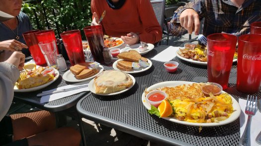
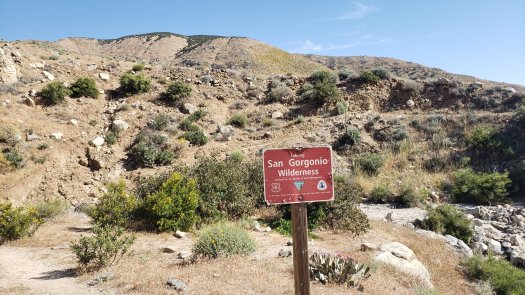
Day 26 was a zero day in Big Bear Lake, spent relaxing and sleeping. I had a nice breakfast at the Grizzly Manor Cafe, and enjoyed dinner with Chris, Kristina, and Emma at Fire Rock Burgers.

I had not yet resupplied in town, so on day 27 I had to do so before leaving town. It was fairly expensive in the resort town. After struggling to get a hitch for awhile, a nice guy gave me a ride back to trail around 1:30. Since it was already so late in the day, I only hiked 13 miles to mile 279.2. The miles went by easily enough, and I camped with some people I’d never met before, spending the evening chatting with GWAG.

I planned to hike 19.3 miles on day 28, and set off a little late but at a brisk pace. I was covering 3.5 miles per hour as the trail headed downhill. I reached my goal rather early, around 3:15 pm, and decided to have my first 20+ mile day on the PCT and continue on. I pushed another 5.4 miles to make it 24.7 miles for the day, my longest day of hiking ever. I also caught up with most of my friends, who had left town a day earlier than I did. I felt great and was elated to have hiked such a long day.

The next day was forecast to be chilly and rain all day, and day 29 didn’t disappoint. There was a picnic area 24.2 miles away, off of mile 328.1, and I urged the group to make the push, as one can order pizza from the picnic area. It rained most of the morning as we made the miles. My feet were soggy and I was chilly, but the rain eventually cleared up in the early afternoon. The trail made its way around Silverwood Lake as we neared the picnic area. At the junction down to our goal, there was a sign proclaiming trail magic ahead. I rushed down to find a group of hikers drying out and enjoying burgers and sodas. I met Fish Tank, the hiker who organized the trail magic. I cheered my friends as they came in, all having completed their longest day. I felt incredibly proud of myself as well, having hiked 48.9 miles in two days. Unfortunately, the forecast for the next day called for more rain and some storms.

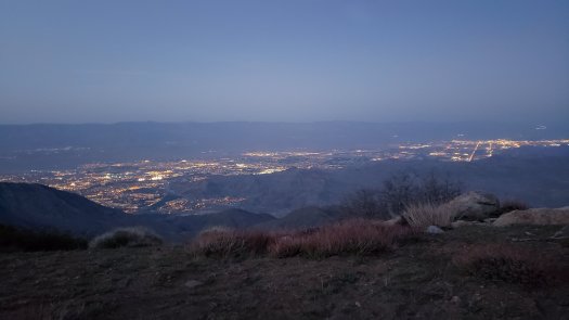
Day 30 also happened to be my 30th birthday. I checked the weather in the morning when I awoke and found that the light rain that was falling was to stop after 8 am; the storms in the previous day’s forecast were no longer expected. Our first goal for the day was Cajon Pass 13.8 miles away, where there is a McDonalds .4 miles off trail. Joren and I hiked together much of the morning, making our way out of the valley containing Silverwood Lake and down to the highway. After getting to McDonalds and stuffing our faces, we grabbed some beer from the gas station and hiked a couple miles to an overlook of Cajon Pass to watch the rail traffic and relax. We passed a couple hours enjoying the view and drinking beer before deciding to hike another 4 miles or so. After about a quarter mile though, we found a nice campsite and the burgers and beer dictated that this was home for the night.

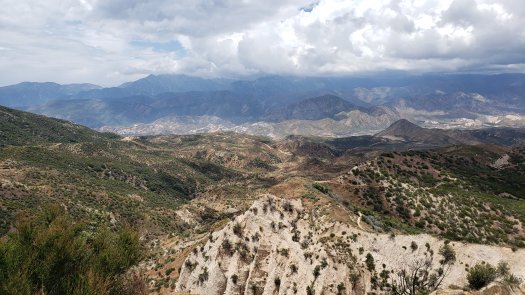
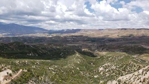
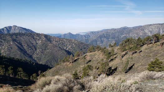
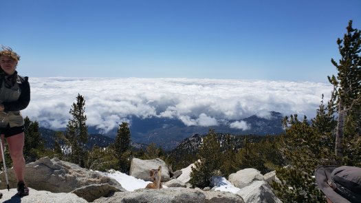
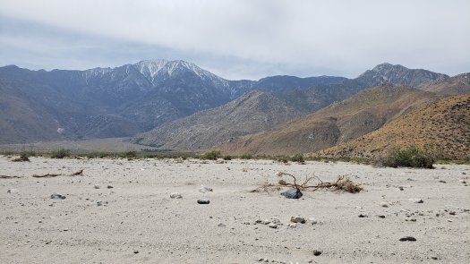
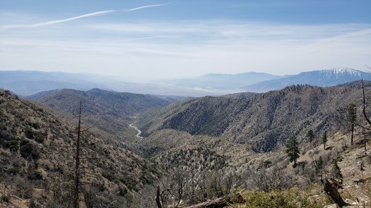
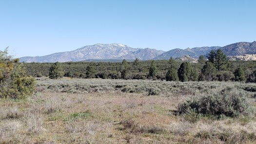
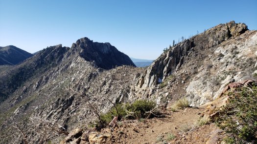
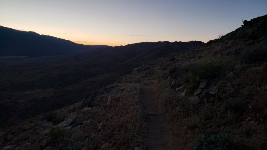
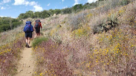
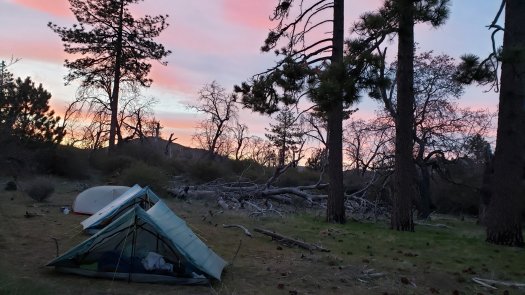
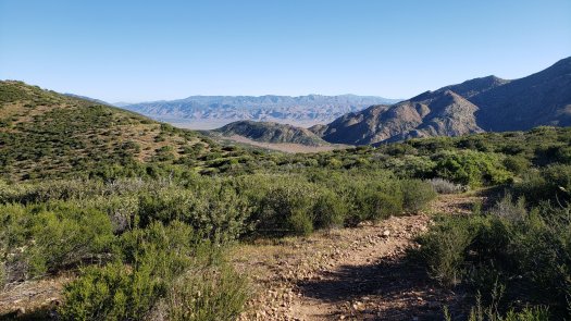
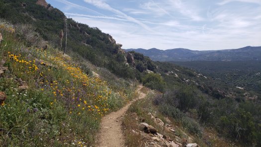
Day 31 marked a month on trail, and we had to make 20.7 miles to Guffy Campground, the next water source. The problem with the day’s hike was the climb: 6650′ of climbing over those 20.7 miles. Thankfully the weather was decent, 70s and partly cloudy. The climb was rarely steep, instead maintaining a steady but persistent incline. After about 8 miles, I began to notice my vision getting funny in my right eye, a sign of a migraine — something from which I suffer occasionally. I pushed another 4 miles through the discomfort until I found a nice shaded place to set up my tent and nap for a couple hours. I woke up shortly after 3 and felt good enough to continue hiking, so I packed up and headed out. The trail had been climbing from a high desert valley all morning, but as I rounded a corner after resuming my hike, the landscape changed dramatically. Mount San Antonio rose above a valley of pine trees, all signs of the desert suddenly gone. I finished the hike and fetched water from Guffy Spring down the incredibly steep side trail. Camped at mile 364.3, we left just 5 miles to Highway 2, where we could hitch into Wrightwood.

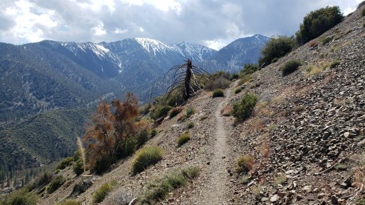
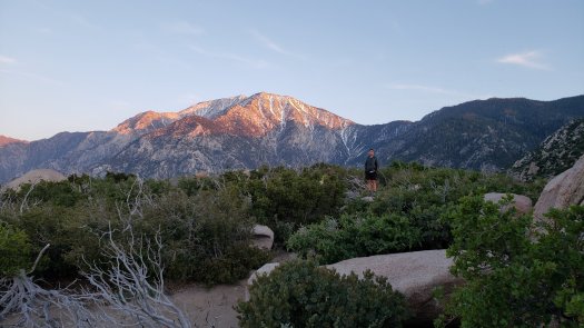
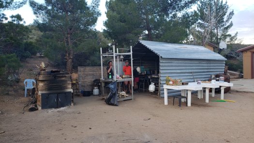
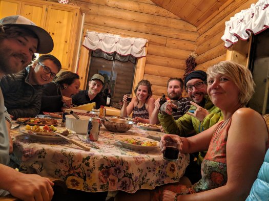
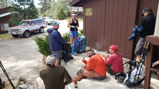
On day 32, we made the 5 miles quickly, enjoying gorgeous views of the canyon and Mount Baden-Powell. We hitched after about 30 minutes down to Wrightwood, a small mountain town northeast of Los Angeles. The local hardware store, Mountain Hardware, is very friendly and helpful towards hikers, stocking gear and letting hikers hang out and charge electronics. I was able to exchange a pair of Darn Tough socks that had gotten a hole, and picked up an additional new pair. We enjoyed breakfast at the Grizzly Cafe before getting picked up by Dave from the Bud Pharm. Dave has been hosting hikers for a decade, providing tent space, showers, laundry, and each night hikers all contribute funds and effort to cook a great dinner and have drinks. There are cats, dogs, chickens, and donkeys at this little hiker paradise, and Dave is a wonderful host. We enjoyed chicken and steak tacos with Modelos to wash it all down.

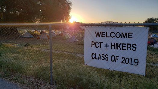
Today is day 33 and we’re still resting at the Bud Pharm. I washed my clothes and showered today, leaving resupply as the only chore left to do in town. We’re thinking about barbeque for dinner. We’ll be heading out in the morning. Next town will be Aqua Dulce, 85 miles away, where we’ll plan on staying at Hiker Heaven.

PCT Days 17-25

Days 17 and 18 ended up being unplanned zero days at the campground in Idyllwild. We learned on Sunday that there was going to be freezing rain on Monday, so we chose to play it safe and wait out the weather in town. These days were rather boring and spent eating and sleeping.

Day 19 was the day we finally headed back onto the mountain and summited the peak of San Jacinto. We hitched a ride out of a foggy and cold Idyllwild up to Humber Park, where the Devil’s Slide trail begins and heads up to Saddle Junction, where we had left the trail. As Humber Park itself is about 1500 feet above Idyllwild, we were above the clouds and in the sun when we started hiking. After the 1500′ ascent in 2.5 miles on Devil’s Slide, we climbed another 900′ on the PCT to the junction with the San Jacinto peak trail. From there, there were occasional patches of snow but nothing too bad until the junction with the Round Valley trail, after which the trail became steep and completely covered in snow. We pushed the last few miles through the snow and wind, summiting around 2 pm. The view was incredible, with a sea of clouds below us to the west and south, and incredible views of San Gorgonio and the Coachella valley to the north and east. At 10,834 feet, the peak of San Jacinto stands nearly 2 miles above Palm Springs below. After admiring the view and getting some pictures, we headed back down to the PCT, practicing (rather poorly) some glissading on the way down. We hiked another 2.5 miles to the strawberry camp and called it a day. The day was just under 13 miles including the side trail and peak trail, and it took us 10 hours to do. The snow on the way up and down was no joke, even with microspikes. Tomorrow we would be hiking Fuller Ridge, some of which was said to be snow covered and tough to navigate.

Day 20 was a 13.9 mile day from mile 183.3 to 197.2. I had a little bit of a sore throat the previous day and had coughed a bit on the way up but had thought it was due to elevation. The morning of day 20, though, it was immediately obvious upon waking up that I had a nasty cold. This made the climb early in the morning very difficult. We then reached the beginning of the Fuller Ridge trail. The first couple miles were mostly snow free and pretty lovely hiking. Once the trail passed over to the north face, however, it became covered in snow, with several sets of footprints to choose from. Ultimately I made it through in decent time, as the section was much flatter and therefore easier than the previous day’s climb to the peak. We then began the long descent from San Jacinto, having finally passed over it. We camped about halfway down the 8000′ descent, and enjoyed a stunning sunset.

Day 21 was to be a 16.2 mile day to the Mesa Wind Farm at mile 213.4. At mile 209.5 though, the trail passes under I-10, so we planned to get lunch at In-n-out and resupply in Cabazon. The descent to the desert wasn’t too bad, but there was a roughly two mile stretch across open desert, with sand that sank below each step like walking on a beach. It was brutal, a brief bit of torture under a blazing sun, with little wind and 90+ degree heat. After finally reaching the interstate, Joren, Benjamin and I got a ride to the In-n-out in Cabazon, where we stuffed our faces. After grabbing enough extra snacks to make it to Big Bear Lake, Thomas, Joker and I got a ride back to trail. I hung out under the highway until about 5 p.m., when it was starting to cool. The remaining 4 miles were a moderate climb to the Mesa Wind Farm, but even this amount of climbing was very difficult with my cold, as I stopped to hack and cough every few hundred feet. The staff at Mesa are very hiker-friendly and provide water and camping, as well as bathrooms and some goodies for sale during office hours. Unfortunately, I didn’t sleep great, as the windmills right above were noisy and my cough persisted through the night.

I awoke on day 22 feeling awful. I debated hiking back to the highway to take a day off, but decided to at least attempt the climb out of the wind farm before retreating to town. I was absolutely exhausted within a half mile, struggling to make any real progress without needing to stop to catch my breath. After a few miles it was clear that I wasn’t going to be hiking very far. It took me 4 hours to hike 6.7 miles to the Whitewater River, a hike that on a typical day would have taken me about 2.5 hours. The sun and heat were both unbearable, regardless of my illness — no clouds, little wind, and again 90+ degrees heat well before noon. At the river, I enjoyed some shade, managed to eat a bit, and rinsed out some clothes before taking a dip myself. I took a long siesta in the shade before deciding shortly after 5 to hike a few more miles. I made it another 3.5 miles before solo camping on a ridge at mile 223.5, with views of San Jacinto, the Coachella valley, and a brilliant sunset behind San Gorgonio.

The next morning I felt a lot better but I didn’t set any particular goal. After an easy few miles down from the ridge, I reached Mission Creek, which the trail follows up San Gorgonio canyon as the creek cuts down from the mountains to the desert. The trail also frequently crosses the creek, requiring many fords. Unfortunately, due to the high amounts of snow and rain this year, the creek had washed out multiple sections of trail, making it tough to follow at times. However, because the trail generally follows the creek up into the mountains, it was easy to continue making progress by simply following the riverbed upstream. With cool, wet feet, I wandered the beautiful wilderness in generally the right direction, sometimes choosing to stick to the riverbed when the trail would briefly ascend from it. I had last seen another person around 7 PM the previous night, and it was after 1 PM before I saw someone else heading up the creek. I believe the solitude, sense of exploration, frequent water and shade, and slightly improved health are the answer to the following, which I specifically stopped to write in my notes: “Day 23 12:26 pm: I am having my best day so far and I’m not sure why.” Despite still hacking and coughing on any even moderately steep climbs, I felt great, and hiked through the heat of the day, enjoying frequent long, lazy breaks in the shade. I ended up making it 16.4 miles to 239.9, the Mission Trail Camp. The day involved over a mile of elevation gain, which any other day would classify as “shitty” in my book — but today was different. The transition from the desert at 3000′ to the high elevation pine forest above 8000′ was remarkable to experience in a single day.

Day 24 had a much more balanced elevation profile than the previous day, but had one caveat: from where I was camped, there was no water source for 16.3 miles until the Arrastre Trail Camp. This meant having to schlep 5.5 liters of water (11 lbs) from the first step in the morning. The day would be spent moving closer to Big Bear Lake, with the trail maintaining elevation above 7500′ all day. This meant that the cloudless day was absolutely perfect weather, likely about 75 in the sun and maybe 65 in the shade. I turned on an audiobook early and cruised, the miles passing quickly and easily behind Brandon Sanderson’s tale. After just over 12 miles, I saw the most wondrous sign a thru-hiker can see: “Free Meal for PCT Hikers Today!” I followed the dirt trail away from the PCT and down to the pullout at Onyx Summit, where a group of trail angels provided burgers, snacks, and drinks. This was a godsend, truly trail magic for me, as I had been very absent-minded when last resupplying and was stuck with basically all sweet food. A salty cheeseburger, chips, and Del Taco burritos to pack out for dinner made my day. I eventually waddled back to the trail and quickly made the last 4 miles to my original plan, the Arrastre camp at mile 256.2.

Today is day 25, and I am relaxing in a comfortable hotel room in Big Bear Lake. It was an easy 10 mile hike to the highway today, where another hiker was just getting into a car as I walked up, and I was offered a ride as well. After getting my own room for two nights (the rate was good and I wanted my own space for a bit), I showered, walked to the laundromat and did laundry, then enjoyed a massive wet carne asada burrito next door. I was reunited with the group I had been hiking with since the start, having fallen behind on day 22. Hopefully going to grab drinks later with them. Tomorrow will be a zero day during which I plan to do very little, as I’m hopeful that getting some rest will finally end this cold. Once we leave Big Bear, we’ll head generally west about 100 miles to Wrightwood, which will be our longest resupply stretch yet. I’m hoping to start hiking some 20+ mile days, assuming my cold gets better.

PCT Days 11-16

Day 10 ended up being a zero at Warner Springs. I hiked out early the next morning to start day 11, crossing another gorgeous meadow before beginning the day’s 2200 ft ascent. I was planning to go to Mike’s Place, a weird hiker haven in the middle of nowhere, 17.8 miles away. For the first time in over a week, I got out of my tent in the morning without bad foot pain, which made me happy and relieved. I covered the nearly 18 miles in about 8 hours, with a few bouts of rain in the early afternoon.

Mike’s Place is interesting. It’s a few acres, with a midsize house and a whole lot of junk. Mike is the owner of the property, but he’s not there very often. Instead, he trusts a few hikers a year to run the place. There’s ingredients for wood fire oven pizza, beer and soda, outhouse, camping, and water, and it’s all based on donations from other hikers. It’s a really cool place despite initial appearances, and definitely worth a stop.

Day 12 was an 18.5 mile hike to mile 145.4. The blister on my right foot returned with a vengeance, growing to at least the size of a half-dollar. I made the miles fairly quickly, considering the annoying pain from my blister. There were frequent views of Mt. San Jacinto, its peak of over 10,000 feet towering over nearby mountains. The south face remains heavily snow-covered, an indication of what lies ahead for us. Water sources have become questionable and spread out. Stagnant pools, murky cisterns, and dried up streams mean planning your day around artificial clean water sources, provided by amazing volunteers. I ended my day on the property of one of these trail angels, Mary, who offers water, shade, outhouse and bucket shower, and camping. There’s also a little free library and some neat cutouts of Whitman, Muir, and Thoreau. Mary stopped by with her dog in the evening and told us about how she got started doing this and how it’s evolved over time. I went to sleep with the desert ground still hot underneath me.

Day 13 included a trip to the Paradise Valley Cafe after a 6.7 mile morning. I ate an enormous breakfast burrito and then hitched a few miles up the road with Flower to buy cigarettes. A quick hitch back to the cafe and I was reunited with most of the people I had been hiking with, after outpacing them the day before. We figured out plans for Idyllwild and I booked a cabin for 8 people for two nights, Friday and Saturday. It has been a week and nearly 100 miles since my last proper shower and laundry, so I am looking forward to getting clean and relaxing a bit. We will see our first snow on trail tomorrow supposedly. Hoping to summit San Jacinto on Monday. I hiked another 4 miles to mile 155.9, taking a slightly shorter day to let my blister heal a bit hopefully. Not sure what the goal for tomorrow is.

Our plan for day 14 was to make it at least to Apache spring, 13.2 miles ahead. The day was spent mostly climbing the mountains southeast of San Jacinto as we gained elevation towards the summit. Water sources along this section of trail can only be found along either steep or long side trails, which ends up adding a lot of time, effort, and distance to the day. The views along this section were stunning though, as the trail eventually made its way to the north face of the mountains. From there, a hiker stands nearly a mile above Palm Springs and the Coachella valley. The peak of San Jacinto looms in the distance, covered in snow. Overall, the day was really tough, with the heat, sun, water, and elevation all playing significant roles. Day 14 in total was 14.3 miles of hiking, with 4300 feet of ascent and 2600 feet of descent, and was definitely the toughest day so far. We camped at Apache spring, overlooking Palm Springs. Awesome campsite though a bit windy. Tomorrow will see us tackling the first snow on trail before hiking down into Idyllwild.

Day 15 called for 10 PCT miles, plus a 2.5 mile side trail into town. The climb up from Apache spring is brutal, a half mile of steep uphill drudgery. Once on the PCT, it wasn’t long until the first snow appeared. These first sections were very brief and easily crossed. After climbing for 4 more miles, we reached the real snow. It was very easy to lose the trail by following the wrong footprints. The snow was slushy by midmorning in the 70 degree heat and sun, making hiking slippery at times. I didn’t have my microspikes yet, so traction was hard to come by. After sliding down to the Tahquitz Valley trail junction, we climbed to the Tahquitz Peak trail junction, a steep .7 mile climb up 500 feet, all snow covered. This was exhausting and navigation was very difficult sometimes due to many misleading footprints. Finally we descended to Saddle Junction and Benjamin and I had to hurry to get to town before the post office closed. A quick ride later and we arrived well in time, collecting our packages. I shipped a few things home to compensate for the added weight of microspikes and my fleece.

Eight of us rented an Airbnb cabin for the night and the next day, so we headed there to relax and do laundry and shower. Everyone else rolled in eventually, and we went to the market to get beer and wine and steaks and salad. We enjoyed a great dinner together and talked late into the night.

Today is day 16 and we’re enjoying a zero day in Idyllwild. Benjamin and I had great omelets at Tommy’s Kitchen for breakfast. The rest of the day will be spent relaxing, sleeping, and eating. We plan to do a short day tomorrow as the climb back up to the PCT from Idyllwild is significant. We’ll do a few more miles before making camp near the junction of the San Jacinto peak trail, and plan to summit Monday morning. According to the latest report, it will be a steep, snowy climb with difficult navigation at times. I can’t wait for the challenge and the views.

PCT Days 7-10

On Day 7, I intended on resupplying at the RV park, but they didn’t have fuel so I needed to hitch to Julian again. As a friend on the AT last year said, “you gotta show a little thigh!” I had lunch while in town and the people eating next to me paid for my lunch without saying a word! Really awesome surprise. Day 7 ended with an 8 mile hike to mile 85.3. We left Scissors Crossing around 4:30 pm and finished the hike under moonlight. It was a beautiful, warm night and we enjoyed wine and the moonlit mountains all around. Overall a great day!

Day 8 was a 15.8 mile hike to mile 101.1. It was a hot and sunny morning and my left foot was hurting rather badly during the first 6 miles to the Third Gate water cache. We filled up at this blessing that breaks up what would be a 24 mile dry stretch. Our plan was to relax in the shade and do the last 10 or so miles in the late afternoon to avoid the heat.

It was buggy though, and I got bored and decided to hike through the heat of the day. I began the 5 mile climb at 11:30. Occasional cloud cover and a little breeze helped make the heat manageable. The last 5 miles or so were a fairly gentle descent to the large campsite and spring at mile 101.1. When I arrived, well ahead of my group, I was a bit surprised to find 25 or so hikers and some trail angels setting up trail magic for dinner and giving out beer and snacks. Eventually there were around 40 hikers, all well fed by these lovely locals. When we ran out of beer around 7 pm, they went and got at least four more cases. I met tons of new people at this spontaneous party with strangers in the wild. It was a fantastic night.

Our plan for day 9 was to hike the 8.4 miles to Warner Springs at mile 109.5. After a brief climb through desert scrub and chaparral, we walked into a gorgeous meadow of wildflowers, surrounded by the mountains of Southern California. We made our way to Eagle Rock, a large rock formation resembling an eagle. After getting pictures, we finished the hike into Warner Springs. The Warner Springs community resource center offers many services for hikers, including camping, a small resupply, charging stations, bucket showers and laundry, and an outfitter is onsite. We relaxed in the afternoon, and enjoyed a free dinner of vegetarian chili provided by some trail angels. I counted over 50 tents set up in the evening.

Today we are relaxing at Warner Springs, and will likely take a zero or possibly hike just 2.1 miles to a campsite. Planning on making it to Mike’s Place tomorrow.

PCT Days 4-6

Day 4, continued: left campsite around 11 and headed to the general store in Mount Laguna. Bought a few things to get to Julian. Had a couple beers and loitered for a couple hours outside the store before hitting the trail around 2. The views from this section of trail were incredible, including views down thousands of feet to the desert floor. It was very windy on the ridge that the trail follows. Ended up hiking to mile 48.7, where there were ample spots to illegally camp. About 20 or so hikers there last night; camped near the usual crew of Lubos, Teresa, Jason, Joren, and Rainer. It was a fairly windy night.

Day 5 was cold, windy, and wet. We hiked through clouds all day, sometimes with precipitation. There were several sections that had us walking directly into sustained 50 to 60 mph winds. In typical years, a very appetizing non-potable faucet at mile 52.6 can be the last water source until mile 77. Because the comments in the navigation application Guthooks weren’t very recent, we filled up enough to make it to 77 if needed. In my case, this was 5.5 liters of water (12 lbs). Of course, this turned out to not be necessary. We hiked 15 miles total to mile 63.7. The plan for tomorrow is to hike 13.6 miles to the highway at 77.3 and hitch a ride into Julian to eat food and resupply. The rain and wind is supposed to clear overnight, thankfully.

Day 6 was a 13.6 mile hike to Scissors Crossing, a highway junction where it’s easy to hitch a ride into Julian. The day was hot but beautiful, with the trail following a mountainside as it descended steadily to the desert floor. Many sections were rather precarious, with steep drop offs to the side. Joren and I hitched very quickly. Julian is a cute little mountain town, several thousand feet up from where we were picked up. We enjoyed a burger at Julian Cafe, then free pie and ice cream at Moms. We grabbed some beer and then spent 45 minutes trying to hitch out of Julian, before a very nice lady who saw our attempts took pity and gave us a ride. We camped at Stagecoach RV park.

Today on day 7, we are taking our time heading out, planning on a short afternoon hike. Took my first shower and doing laundry now. Left foot still hurts a bit but it’s manageable.

PCT Days 1-3

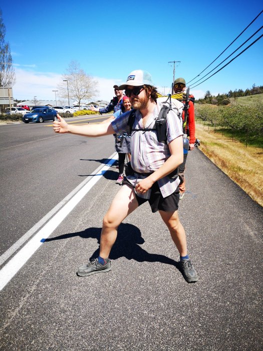
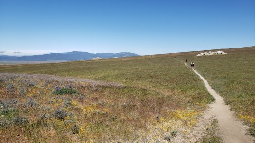
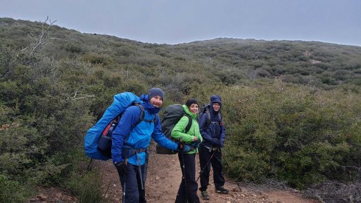
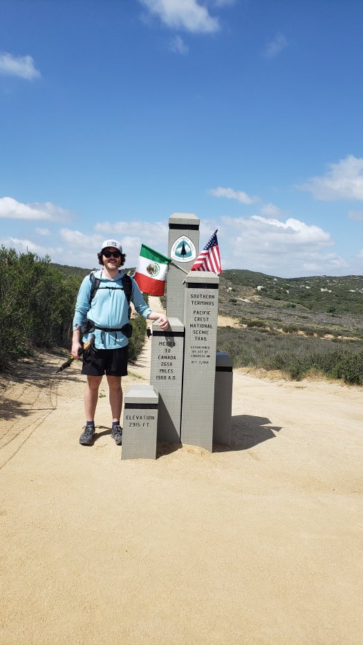
Day 1 (4/12/19):Woke up at 4 after 6 hours of sleep, couldn’t sleep more. Better than last year at least. Got the first bus to Campo. Stopped at the post office then hiked south 1.5 miles to monument. Got picture, signed book, put finger into Mexico through the ugly fence. First few miles went great. Started having a hot spot on right foot around mile 4. Think it will blister. Trail got decently tough with a lot of elevation gain. Made it to mile 11.4 in pouring rain and set up camp. Rain stopped about an hour later. Camped near a few girls but didn’t talk. Enjoying my time in the wild “alone” right now, going to have a more social night tomorrow.
Day 2 was 14.6 miles to Boulder Oaks campground at mile 26. Stopped in Lake Morena for lunch, had a delicious bacon cheeseburger and fries. The climb up Hauser mountain was difficult in the late morning sun. The climb out of Morena was very hot. First rattlesnake was seen right before the campground. Campground was nice, stayed with 10 or so people. Met Joren, Rainer, Kevin, Lubos, Teresa, Jason. Lots of Europeans!
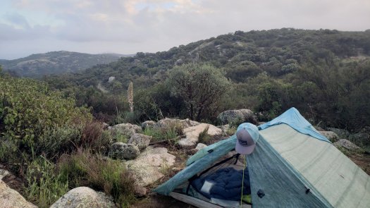
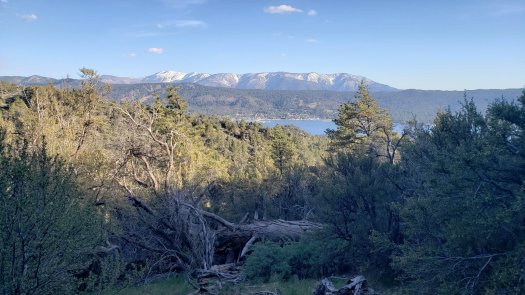
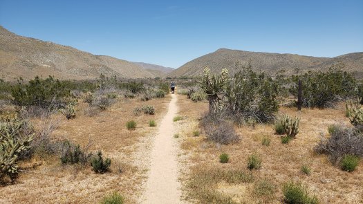
Day 3 was 15.5 miles to mile 41.5, plus maybe .5 to the campground. We climbed all day, nearly 3000 ft in gain. It was beautiful but very difficult by the end. My shoulders were aching for most of the day, but near the end I had a sharp pain in my left foot. This subsided after getting to camp. However, later that night my right hip flexor seized up and made it difficult to walk. Very painful. Camped in mount Laguna with Lubos, Teresa, Joren, and Jason.
Today is day 4, currently just after 9 AM. Planning on leaving here later this afternoon and having a short day. Hip is still pretty tender, left foot isn’t feeling the best either. It’s supposed to be very windy tonight.

PCT Day 0

I flew to San Diego yesterday, escaping the midwest before a large winter storm moved in. Today, I’m relaxing in a hotel in El Cajon, getting ready to hop on the bus to Campo in the morning.

Tomorrow morning, the bus should arrive in Campo shortly after 10. Before walking about 1.5 miles to the border and trailhead, I need to stop at the post office in Campo to pick up a box I sent. In order to save a few dollars and avoid the risk of lost luggage, I shipped all the things you can’t fly with in your carry-on (trekking poles, tent stakes, pocket knife, etc.). I also have my first few days of food in this box. After getting all that loaded up and walking south briefly, I should be at the southern terminus by 11 AM. Not the best time of day to start hiking in the desert, but the forecast appears mild so it should be okay.

I’m very excited to be starting another long hike. Waking up each day for your own purpose, with no one to dictate what you do with your time, is incredibly satisfying and rewarding. Sleeping outdoors, away from the noise and people of the city; watching every sunrise and every sunset with lovely scenery around; eating thousands of calories of junk food daily and still losing weight… just a few of the best things about thru hiking.

The best part about a long hike, though, is the incredible cast of characters you meet along the way. Just about everyone who willingly heads out into the wild for that long has a story to tell that’s worth hearing, and a personality worth knowing.

Next post will be from on the trail! Can’t wait to get started tomorrow.